If you wish to contribute or participate in the discussions about articles you are invited to contact the Editor
Civil Applications: Difference between revisions
Rui.Pereira (talk | contribs) No edit summary |
Rui.Pereira (talk | contribs) No edit summary |
||
| Line 12: | Line 12: | ||
== Personal Applications == | == Personal Applications == | ||
[[File:Galileo 01 wp02.jpg|right|thumb|300px|Personal Applications]] | |||
The availability of cheap GNSS chipsets allowed for integration of GNSS in different consumer products such as mobile phones. As a consequence, GNSS started being used not only for professional activities but also for leisure and entertainment purposes. | The availability of cheap GNSS chipsets allowed for integration of GNSS in different consumer products such as mobile phones. As a consequence, GNSS started being used not only for professional activities but also for leisure and entertainment purposes. | ||
| Line 25: | Line 27: | ||
== Road Applications == | == Road Applications == | ||
[[File:02947A4.jpg|right|thumb|150px|Road Applications]] | |||
Road Navigation was the first consumer GNSS application to have generalized use worldwide. The road market currently accounts for more than 50% of the revenue and shipments and the main GNSS application is Road Navigation. | Road Navigation was the first consumer GNSS application to have generalized use worldwide. The road market currently accounts for more than 50% of the revenue and shipments and the main GNSS application is Road Navigation. | ||
| Line 40: | Line 44: | ||
== Aviation Applications == | == Aviation Applications == | ||
[[File:Airplane GPS.jpg|right|thumb|300px|Aviation Applications]] | |||
In the major transport domains, and notably in aeronautical applications, satellite navigation has long been an additional means of localization. The development of GPS has provided a supplementary positioning service for many flight phases, in leisure flying as well as commercial air transport<ref name="Gal_Aviation">[http://galileo.khem.gov.hu/documents/angol/prospektusok/galileo_alkalmazasok/aviation.pdf Galileo Application Sheet - Aviation], ESA and European Commission, October 2002</ref>. | In the major transport domains, and notably in aeronautical applications, satellite navigation has long been an additional means of localization. The development of GPS has provided a supplementary positioning service for many flight phases, in leisure flying as well as commercial air transport<ref name="Gal_Aviation">[http://galileo.khem.gov.hu/documents/angol/prospektusok/galileo_alkalmazasok/aviation.pdf Galileo Application Sheet - Aviation], ESA and European Commission, October 2002</ref>. | ||
| Line 54: | Line 60: | ||
== Rail Applications == | == Rail Applications == | ||
The railway domain can considerably profit from the implementation of autonomous on-board positioning systems. Especially for local and regional railway lines, there are various possible applications which could enable a cost-effective modernization and increase of efficiency<ref name="ESA_Benefits">[http://www.esa.int/esaNA/GGGOMB50NDC_index_0.html ESA Portal - Navigation - Who benefits: some practical applications], ESA, October 2004</ref>. | The railway domain can considerably profit from the implementation of autonomous on-board positioning systems. Especially for local and regional railway lines, there are various possible applications which could enable a cost-effective modernization and increase of efficiency<ref name="ESA_Benefits">[http://www.esa.int/esaNA/GGGOMB50NDC_index_0.html ESA Portal - Navigation - Who benefits: some practical applications], ESA, October 2004</ref>. | ||
| Line 63: | Line 70: | ||
== Maritime Applications == | == Maritime Applications == | ||
[[File:Galileo 02 wp04.jpg|right|thumb|250px|Maritime Applications]] | |||
The sea and waterways are the most widely used mode for transporting goods worldwide. A wide variety of vessels moves around the world each day. Satellite navigation benefits all maritime applications, including leisure boats, commercial vessels, as well as unregulated and Safety of Life at Sea regulated ships<ref name="ESA_Benefits"/>. | The sea and waterways are the most widely used mode for transporting goods worldwide. A wide variety of vessels moves around the world each day. Satellite navigation benefits all maritime applications, including leisure boats, commercial vessels, as well as unregulated and Safety of Life at Sea regulated ships<ref name="ESA_Benefits"/>. | ||
| Line 75: | Line 84: | ||
== Industry Applications == | == Industry Applications == | ||
[[File:Galileo 02 wp02.jpg|right|thumb|250px|Industry Applications]] | |||
Industry uses heavy machinery for many purposes. Satellite navigation and GNSS augmentation techniques can guide these machines precisely to perform their work. The same technique can be used for automated guidance of machines working in dangerous areas or simply to save manpower in repetitive work<ref name="Gal_CivilEng">[http://www.galileoic.org/la/files/Civil%20Engineering.pdf Galileo Application Sheet - Civil Engineering], ESA and European Commission, June 2002</ref>. | Industry uses heavy machinery for many purposes. Satellite navigation and GNSS augmentation techniques can guide these machines precisely to perform their work. The same technique can be used for automated guidance of machines working in dangerous areas or simply to save manpower in repetitive work<ref name="Gal_CivilEng">[http://www.galileoic.org/la/files/Civil%20Engineering.pdf Galileo Application Sheet - Civil Engineering], ESA and European Commission, June 2002</ref>. | ||
Revision as of 16:42, 8 April 2011
| Applications | |
|---|---|
| Title | Civil Applications |
| Author(s) | Rui Barradas Pereira. |
| Level | Basic |
| Year of Publication | 2011 |
The initial purpose of the first GNSS systems (GPS and GLONASS) was military but very early in the experimental phase of GPS the incident with the Korean Air Lines Flight 007 lead the US Government to decide to make GPS use free for civilian purposes[1].
Currently the use of GNSS systems in Civil Applications is generalized and every GNSS system in operation or in construction takes civil applications as one of the most important uses of GNSS systems.
Personal Applications
The availability of cheap GNSS chipsets allowed for integration of GNSS in different consumer products such as mobile phones. As a consequence, GNSS started being used not only for professional activities but also for leisure and entertainment purposes.
Some of these uses bring comfort to the user and can save the user time. Others are just to facilitate social interactions not bringing a tangible benefit to the user. The fact that the technology is available and free to use, allows for these types of uses.
Different types of personal applications are:
Detailed information about Personal Applications can be found here.
Road Applications
Road Navigation was the first consumer GNSS application to have generalized use worldwide. The road market currently accounts for more than 50% of the revenue and shipments and the main GNSS application is Road Navigation.
Besides Road Navigation, GNSS is also used for other road applications such as vehicle tracking. Vehicle tracking can be used for different purposes that can range from fleet management to the request of emergency services.
Different types of road applications are:
- Road Navigation
- Tolling
- Emergency Services
- Traffic Management
- Fleet Management & Vehicle Tracking
- Enforcement
Detailed information about Road Applications can be found here.
Aviation Applications
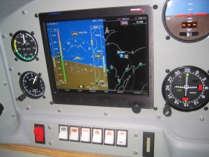
In the major transport domains, and notably in aeronautical applications, satellite navigation has long been an additional means of localization. The development of GPS has provided a supplementary positioning service for many flight phases, in leisure flying as well as commercial air transport[2].
In the future, GNSS is expected to assist pilots in all flight phases, from movement on the ground, to take-off, en-route flying, and landing in all weather conditions, reaching the level of safety that will be required to cope with the continuous increase in the number of flights[2].
Different types of aviation applications are:
Detailed information about Aviation Applications can be found here.
Rail Applications
The railway domain can considerably profit from the implementation of autonomous on-board positioning systems. Especially for local and regional railway lines, there are various possible applications which could enable a cost-effective modernization and increase of efficiency[3].
However, train control poses high demands on positioning with respect to availability, reliability and integrity. These requirements can only be fulfilled by means of integrated positioning systems which combine GNSS with other sensors[3].
The main rail application is Traffic Management and Signalling.
Detailed information about Rail Applications can be found here.
Maritime Applications
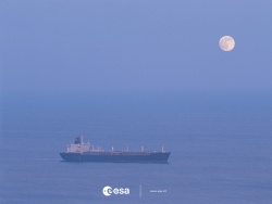
The sea and waterways are the most widely used mode for transporting goods worldwide. A wide variety of vessels moves around the world each day. Satellite navigation benefits all maritime applications, including leisure boats, commercial vessels, as well as unregulated and Safety of Life at Sea regulated ships[3].
Satellite navigation can be used in every phase of marine navigation: ocean, coastal, port approach and port maneuvers, under all weather conditions.
Different types of maritime applications are:
Detailed information about Maritime Applications can be found here.
Industry Applications
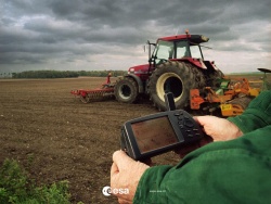
Industry uses heavy machinery for many purposes. Satellite navigation and GNSS augmentation techniques can guide these machines precisely to perform their work. The same technique can be used for automated guidance of machines working in dangerous areas or simply to save manpower in repetitive work[4].
The computer compares the GNSS position with the desired work profile and provides visual guidance to the operator for maneuvering the vehicles. The use of satellite-based machine guidance systems in surface mines is becoming common with very positive results in productivity and costs[4].
Different types of industry applications are:
Detailed information about Industry Applications can be found here.
Notes
References
- ^ Global Positioning System on Wikipedia
- ^ a b Galileo Application Sheet - Aviation, ESA and European Commission, October 2002
- ^ a b c ESA Portal - Navigation - Who benefits: some practical applications, ESA, October 2004
- ^ a b Galileo Application Sheet - Civil Engineering, ESA and European Commission, June 2002


