If you wish to contribute or participate in the discussions about articles you are invited to contact the Editor
Industry Applications: Difference between revisions
| Line 16: | Line 16: | ||
== Precision Agriculture == | == Precision Agriculture == | ||
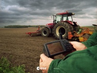
[[File:Galileo 02 wp02.jpg|right|thumb|200px|Precision agriculture]] | |||
The agricultural community will face great challenges in a worldwide scale during the next years. Farmers will have to compete with quality products, while respecting the environment and earning profits at the same time. Meanwhile, the world population it will continue to increase, creating a constant demand and pushing for a production increasing. | The agricultural community will face great challenges in a worldwide scale during the next years. Farmers will have to compete with quality products, while respecting the environment and earning profits at the same time. Meanwhile, the world population it will continue to increase, creating a constant demand and pushing for a production increasing. | ||
Revision as of 11:19, 23 May 2011
| Applications | |
|---|---|
| Title | Industry Applications |
| Author(s) | GMV. |
| Level | Medium |
| Year of Publication | 2011 |
Industry uses heavy machinery for many purposes. Satellite navigation and GNSS augmentation techniques can guide these machines precisely to perform their work. The same technique can be used for automated guidance of machines working in dangerous areas or simply to save manpower in repetitive work[1].
The computer compares the GNSS position with the desired work profile and provides visual guidance to the operator for maneuvering the vehicles. The use of satellite-based machine guidance systems in surface mines is becoming common with very positive results in productivity and costs[1].
Overview of Industry Applications
Precision Agriculture
The agricultural community will face great challenges in a worldwide scale during the next years. Farmers will have to compete with quality products, while respecting the environment and earning profits at the same time. Meanwhile, the world population it will continue to increase, creating a constant demand and pushing for a production increasing.
Satellite navigation is being use in agricultural applications in order to monitoring of crop and soil as well as surveying the fertility of agricultural fields in order to control the distribution of chemicals and fertilizers.
The needs of the fishing sector have also grown, ranging from day-to-day operational support to the navigation and positioning of fishing vessels. Strict international rules governing intrusion into national waters demand that vessels are monitored to check they work only in designated areas.[2]
Detailed information about Precision Agriculture can be found here.
Package and Container Tracking
Detailed information about Package and Container Tracking can be found here.
Mining
Detailed information about Mining can be found here.
Notes
References
- ^ a b Galileo Application Sheet - Civil Engineering, ESA and European Commission, June 2002
- ^ Galileo Application Sheet - Agriculture, ESA and European Commission, June 2002

