If you wish to contribute or participate in the discussions about articles you are invited to contact the Editor
Uploads by Irene.Hidalgo
Jump to navigation
Jump to search
This special page shows all uploaded files.
| Date | Name | Thumbnail | Size | Description | Versions |
|---|---|---|---|---|---|
| 20:47, 17 August 2011 | Isrologo.jpg (file) |  |
2 KB | ISRO logo. www.isro.org | 1 |
| 08:24, 19 August 2011 | Jaxalogo.PNG (file) |  |
7 KB | Jaxa logo taken from www.jaxa.jp | 1 |
| 13:42, 12 April 2011 | PortControl.jpg (file) |  |
10 KB | Port State Control: a PRS Application. European Maritime Safety Agency (EMSA) Web Page | 1 |
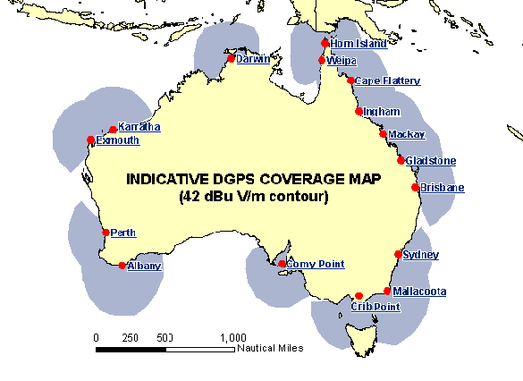
| 14:28, 8 June 2011 | DGPS AustraliaCoverageMap.gif (file) |  |
10 KB | Australia DGPS System, Coverage Map taken from Australian Maritime Safety Authority webpage. | 1 |
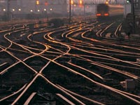
| 13:28, 12 April 2011 | Rail.jpg (file) |  |
10 KB | Applications transportation. GPS public web page | 1 |
| 12:31, 15 July 2011 | CompassApplication.jpg (file) |  |
11 KB | Image taken from Compass Status presentation: http://www.filasinternational.eu/sidereus-project/pdf/02.pdf | 1 |
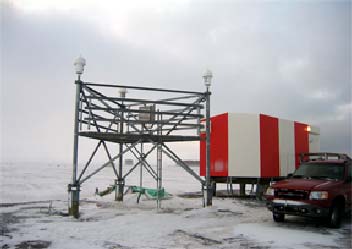
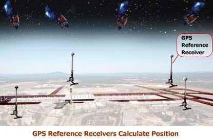
| 09:51, 17 June 2011 | WAAS Reference Station Barrow Alaska.jpg (file) |  |
12 KB | WAAS Reference Station Barrow Alask. FAA | 1 |
| 14:34, 8 June 2011 | DGPSAustraliaCoverageMap.PNG (file) |  |
14 KB | DGPS by Australian Maritime Safety Authority. | 1 |
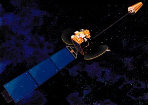
| 14:01, 5 July 2011 | MTSAT-1.jpg (file) |  |
14 KB | Image MTSAT-1 Satellite from Wikipedia en Español. (Source: http://rsd.gsfc.nasa.gov/goes/text/geonews.html) | 1 |
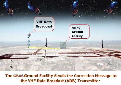
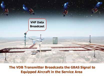
| 14:13, 12 July 2011 | Laas step1.jpg (file) |  |
14 KB | LAAS How it works, FAA. http://www.faa.gov/about/office_org/headquarters_offices/ato/service_units/techops/navservices/gnss/laas/howitworks/ | 1 |
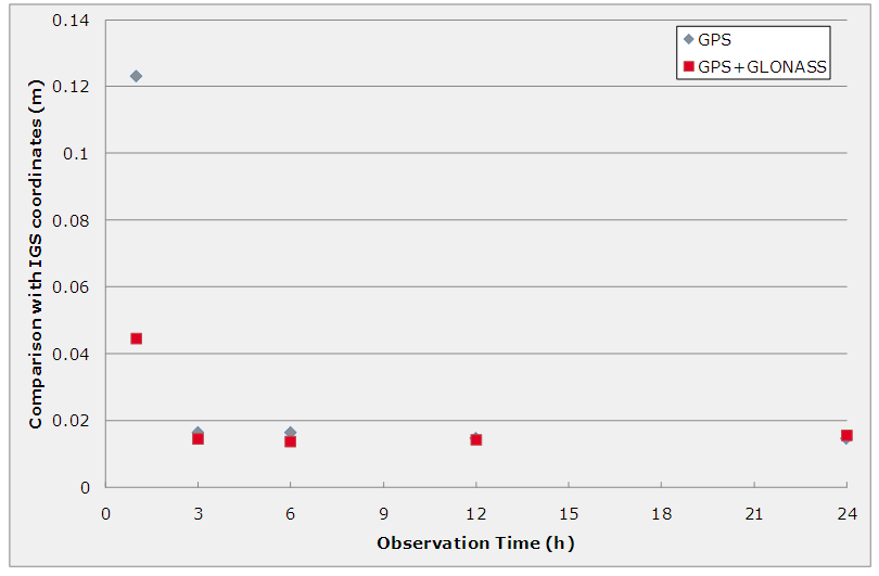
| 15:25, 17 May 2011 | PPP Performances.PNG (file) |  |
16 KB | Static PPP Performances at GLSV. Taken from: http://mycoordinates.org/multisystem-real-time-precise-point-positioning/all/1/ | 1 |
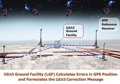
| 14:19, 12 July 2011 | Laas step3.jpg (file) |  |
18 KB | LAAS How it works, FAA. http://www.faa.gov/about/office_org/headquarters_offices/ato/service_units/techops/navservices/gnss/laas/howitworks/ | 1 |
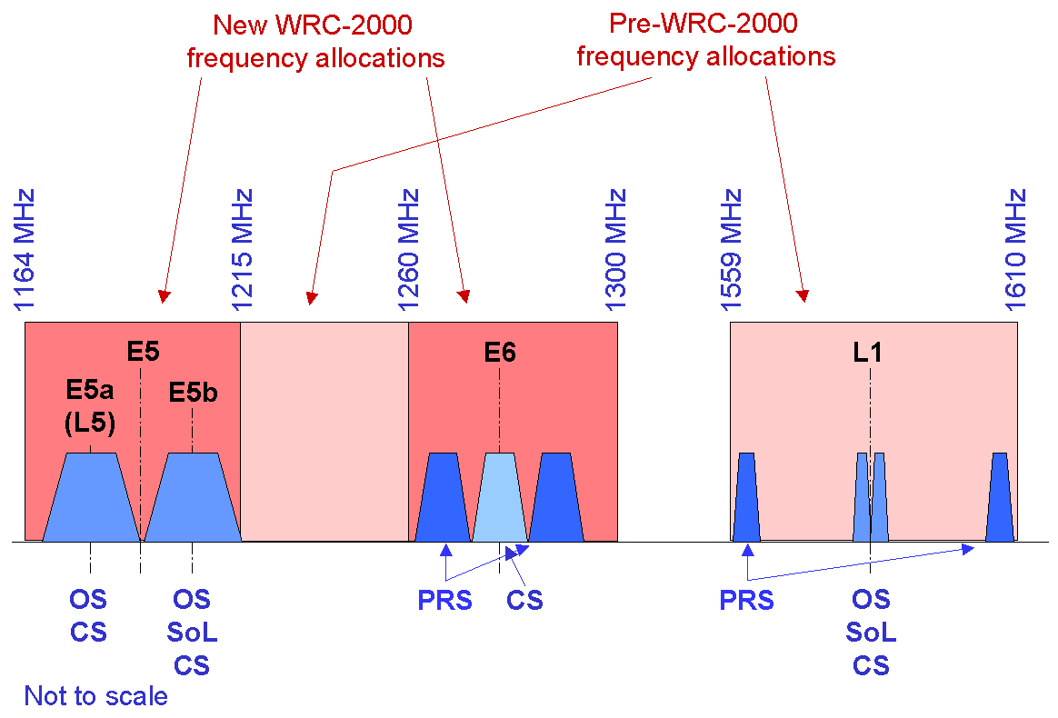
| 07:36, 12 April 2011 | Galileo Frequencies.gif (file) |  |
18 KB | Galileo Frequecies and Services. Image taken from Galileo ESA webpage | 1 |
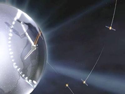
| 08:35, 12 May 2011 | Galileo clock.jpg (file) |  |
18 KB | Image taken from ESA website for European GNSS Evolution program | 1 |
| 10:16, 10 June 2011 | WARTK reciever.PNG (file) |  |
19 KB | Image of gAGE/UPC. WARTK user algorithm | 1 |
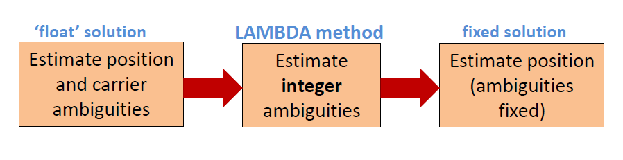
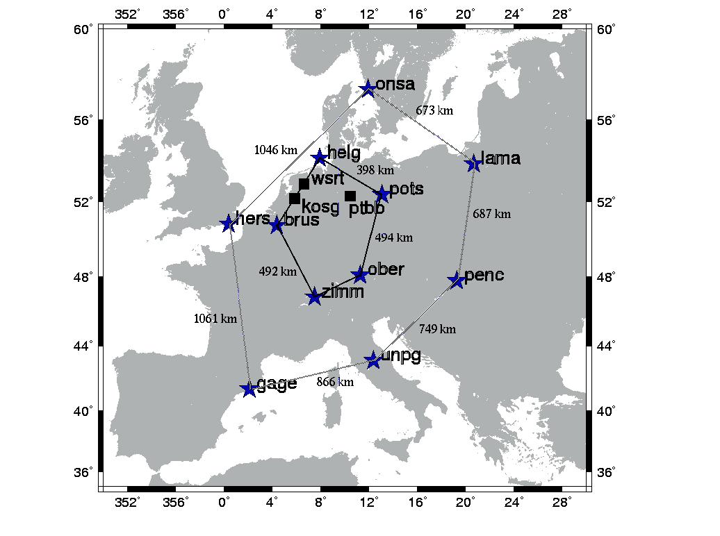
| 10:43, 7 June 2011 | LambdaMethod.PNG (file) | 20 KB | Figure created by Irene Hidalgo, inspired in the one of Delft University Lambda method. | 1 | |
| 14:19, 12 July 2011 | Laas step4.jpg (file) |  |
23 KB | LAAS How it works, FAA. http://www.faa.gov/about/office_org/headquarters_offices/ato/service_units/techops/navservices/gnss/laas/howitworks/ | 1 |
| 14:21, 11 July 2011 | Beidou navigation system.png (file) |  |
24 KB | BeidouCompass logo taken from wikipedia.org: http://en.wikipedia.org/wiki/Beidou_navigation_system | 1 |
| 12:37, 15 July 2011 | CompassConstellation.jpg (file) |  |
24 KB | Compass Space Segment. Image taken from Compass Status presentation: http://www.filasinternational.eu/sidereus-project/pdf/02.pdf | 1 |
| 14:17, 12 July 2011 | Laas step2.jpg (file) |  |
27 KB | LAAS How it works, FAA. http://www.faa.gov/about/office_org/headquarters_offices/ato/service_units/techops/navservices/gnss/laas/howitworks/ | 1 |
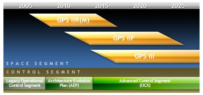
| 05:27, 8 June 2011 | GPSModernSchedule.jpg (file) |  |
28 KB | 3 | |
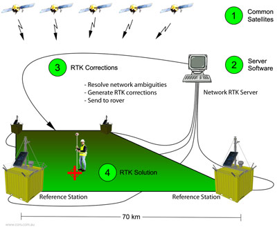
| 07:16, 9 June 2011 | RTK-intro3.jpg (file) |  |
33 KB | Image of RTK technique. Taken from South Australian CORS Network. | 1 |
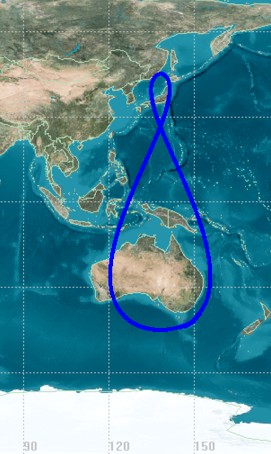
| 08:37, 19 August 2011 | Qzss-45-0 09.jpg (file) |  |
38 KB | QZSS Groundtrack. Image taken from Wikipedia | 1 |
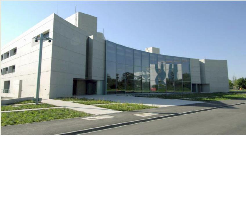
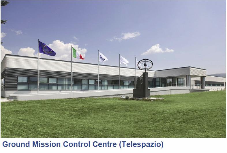
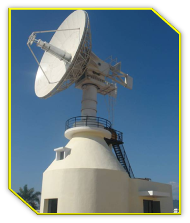
| 13:54, 11 April 2011 | GCC DLR.JPG (file) |  |
47 KB | Ground Control Center DLR Oberhapfaffenhofen. From Benedicto talk in Munich Navigation Congress March 2011 | 1 |
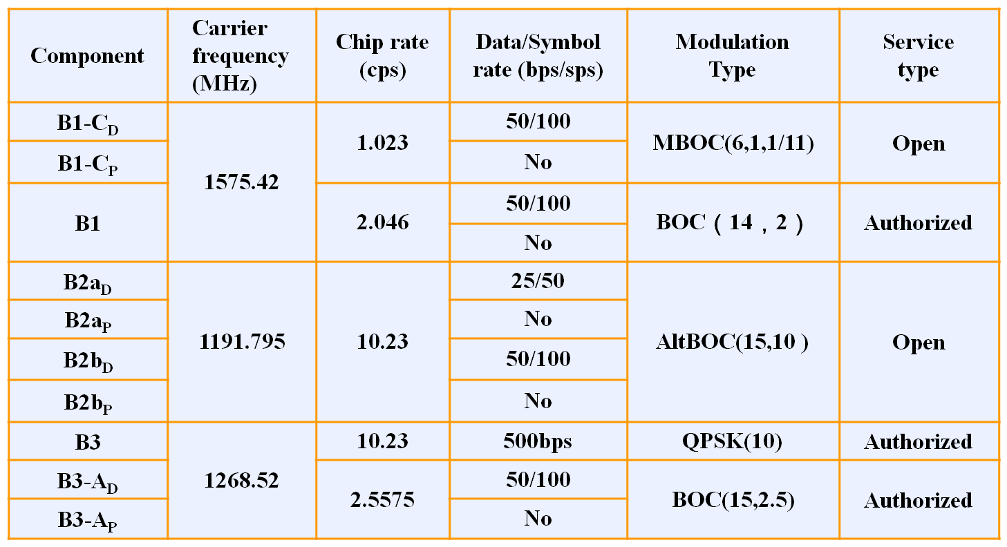
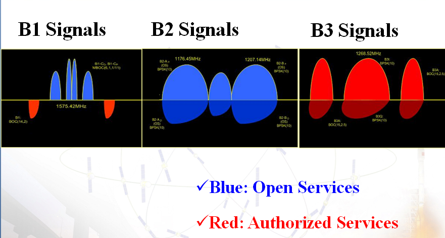
| 10:50, 29 July 2011 | CompassSignals.png (file) |  |
53 KB | Compass Signals characterictics from COMPASS Presentation given by ESA closing action 4 of IRKP-1 meeting. | 1 |
| 14:30, 16 June 2011 | GEO12 2010 WAAS.jpg (file) |  |
57 KB | GEO WAAS: broadcast footprints of the geostationary satellites in December 2010. FAA WAAS News webpage | 1 |
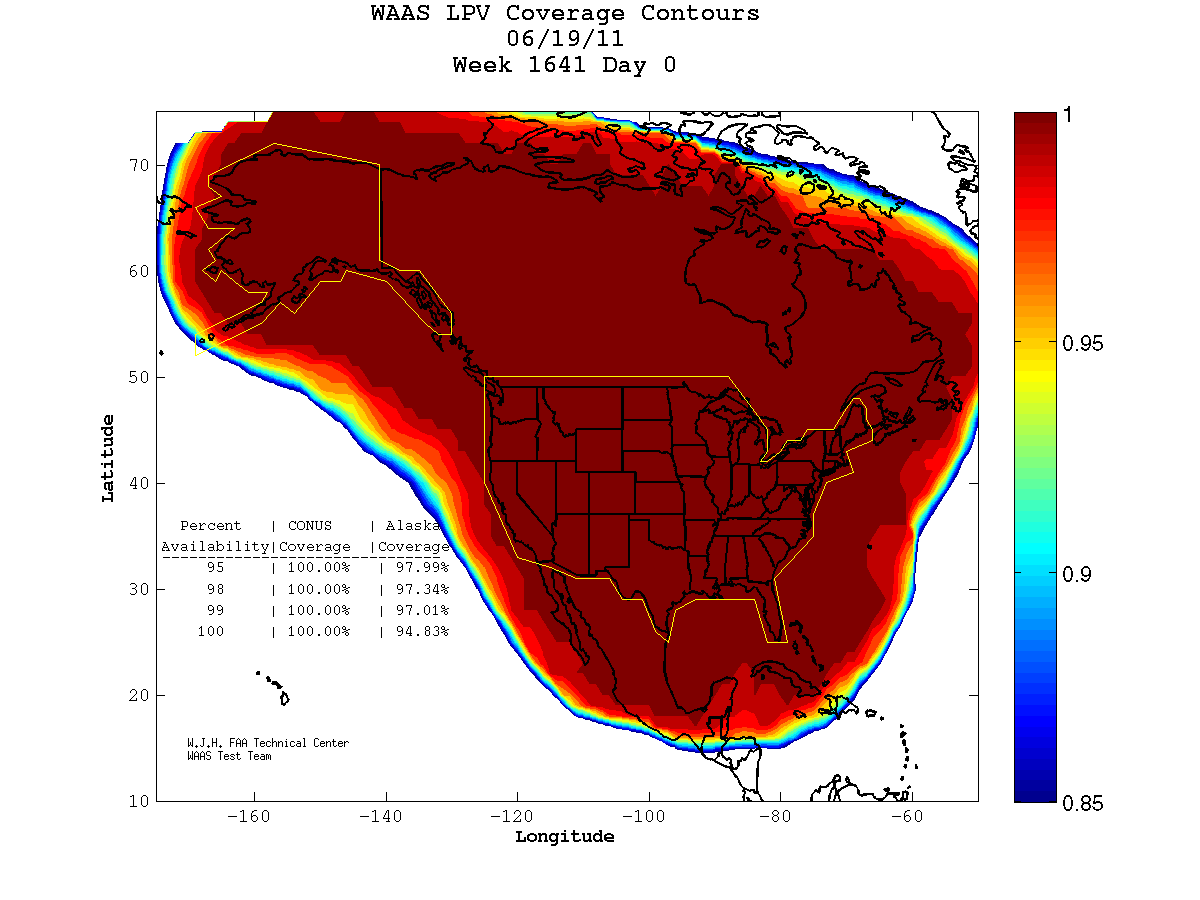
| 15:38, 20 June 2011 | WAASCoverage LPV.png (file) |  |
60 KB | WAAS LPV Coverage Contours 24-hours plot, taken from http://www.nstb.tc.faa.gov/24Hr_WaasLPV.htm | 1 |
| 14:02, 11 April 2011 | GMS Fucino.JPG (file) |  |
60 KB | 2 | |
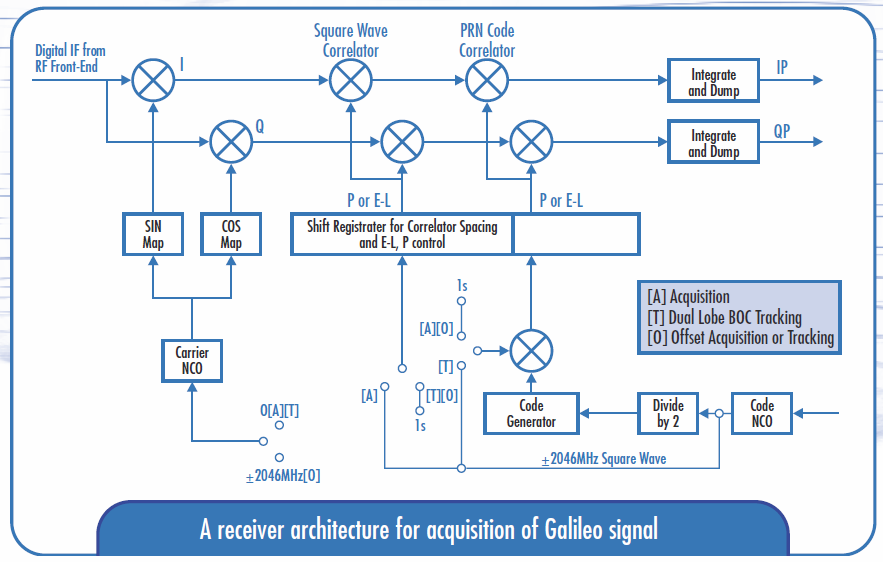
| 14:44, 11 May 2011 | ArchitectureGalileoReceiver.PNG (file) |  |
68 KB | A receiver architecture for acquisition of Galileo signal. Taken from a presentation in esa webpage: http://esamultimedia.esa.int/docs/galileo/ESA_Galileo_RECEIVERS.pdf | 1 |
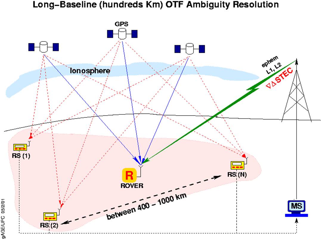
| 08:00, 10 June 2011 | Wartk gAGEUPC.jpg (file) |  |
80 KB | Image WARTK technique, propierty of GAGE/UPC. | 1 |
| 07:01, 15 June 2011 | WARTK2test.JPG (file) |  |
85 KB | WARTK-2 test | 1 |
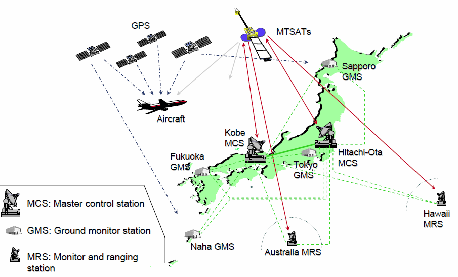
| 10:04, 5 July 2011 | MSAS Architecture.PNG (file) |  |
97 KB | MSAS Architecture image. Taken from CGSIC Meeting presentation: http://www.navcen.uscg.gov/pdf/cgsicMeetings/47/%5B24%5Dqzzmsas.pdf | 1 |
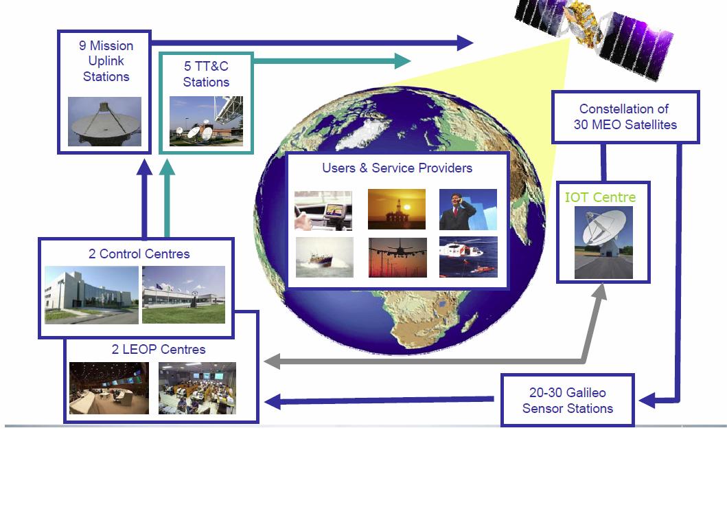
| 08:37, 11 April 2011 | GalileoFOCArchitecture.JPG (file) |  |
102 KB | Galileo Architecture. Taken from Benedicto talks in Munich Navigation Congress March 2011. | 1 |
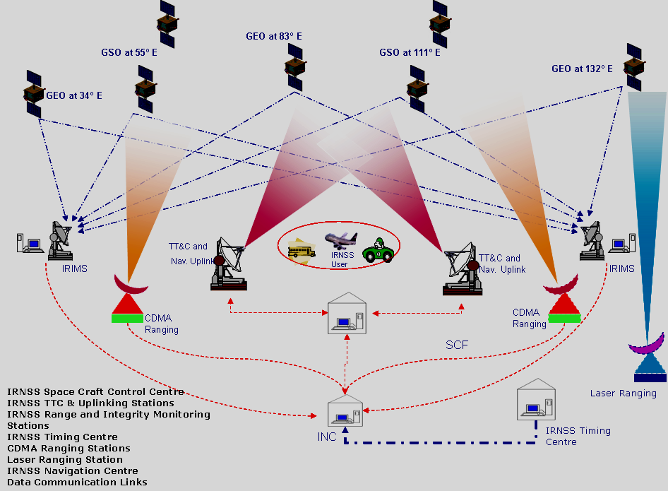
| 21:19, 17 August 2011 | IRNSSArchitecture.PNG (file) |  |
109 KB | IRNSS Architecture. Image taken from COSPAR Presentation. http://www.oosa.unvienna.org/pdf/icg/2008/expert/2-3.pdf | 1 |
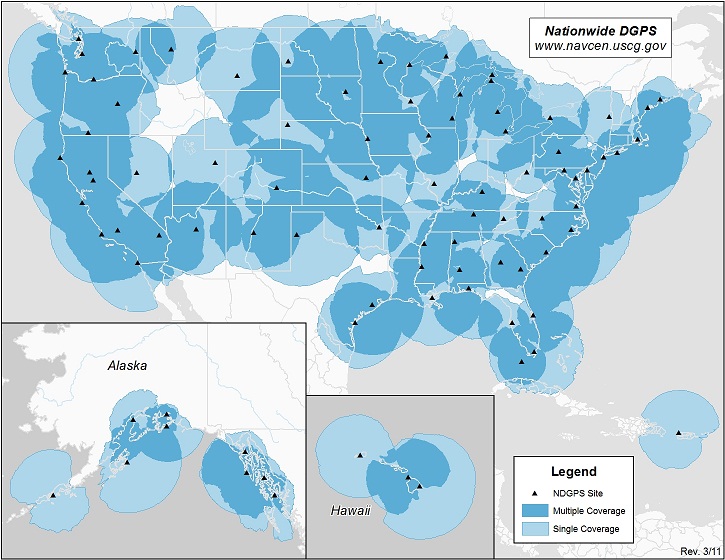
| 14:46, 8 June 2011 | USDGPS coverage.jpg (file) |  |
139 KB | US DGPS Coverage map. Taken from Navigation Center of US Coast Guard | 1 |
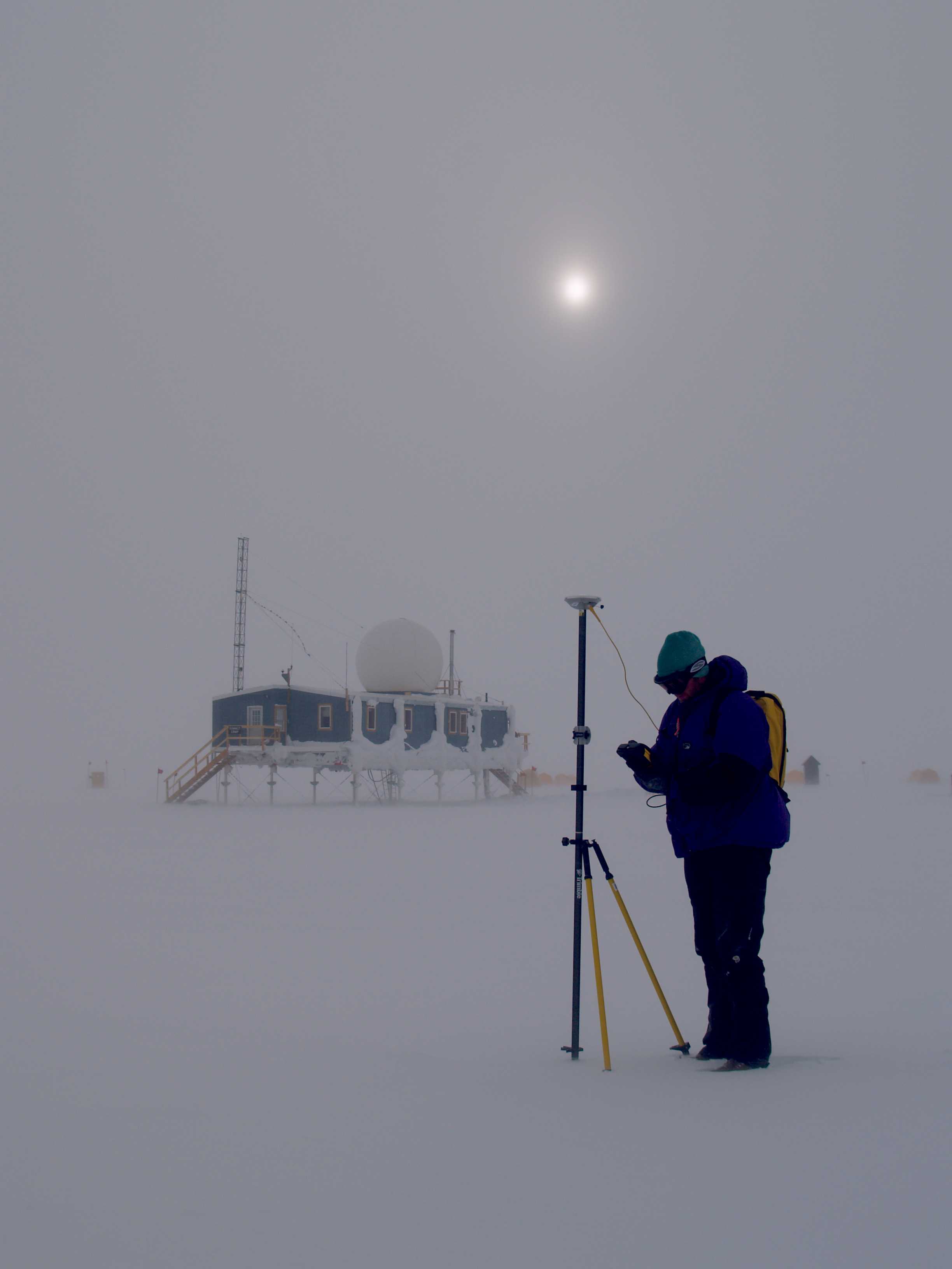
| 07:22, 9 June 2011 | Summit rtk survey.jpg (file) |  |
158 KB | Image taken from UNAVCO.org | 1 |
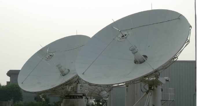
| 12:30, 15 July 2011 | CompassAntena.png (file) |  |
168 KB | Compass Antenna. Image taken from Compass Status presentation: http://www.filasinternational.eu/sidereus-project/pdf/02.pdf | 1 |
| 10:05, 2 September 2011 | CompassAntenas.PNG (file) |  |
186 KB | Compass Antenna. Image taken from Compass Status presentation: http://www.filasinternational.eu/sidereus-project/pdf/02.pdf | 1 |
| 05:30, 8 June 2011 | GPSModernizationProgramSchedule.PNG (file) |  |
213 KB | 1 | |
| 10:54, 29 July 2011 | CompassSpectrum.PNG (file) |  |
215 KB | Compass Signals Spectrum. Image taken from COMPASS Presentation given by ESA closing action 4 of IRKP1 meeting. | 1 |
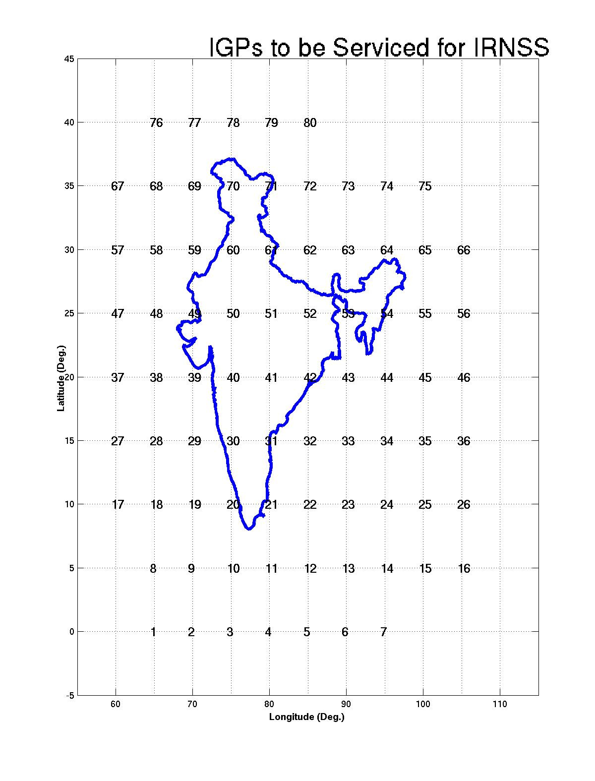
| 21:24, 17 August 2011 | IRNSS IGP.PNG (file) |  |
374 KB | IGPs to be used in IRNSS, Image taken from ICG presentation http://www.oosa.unvienna.org/pdf/icg/2008/icg3/07.pdf | 1 |
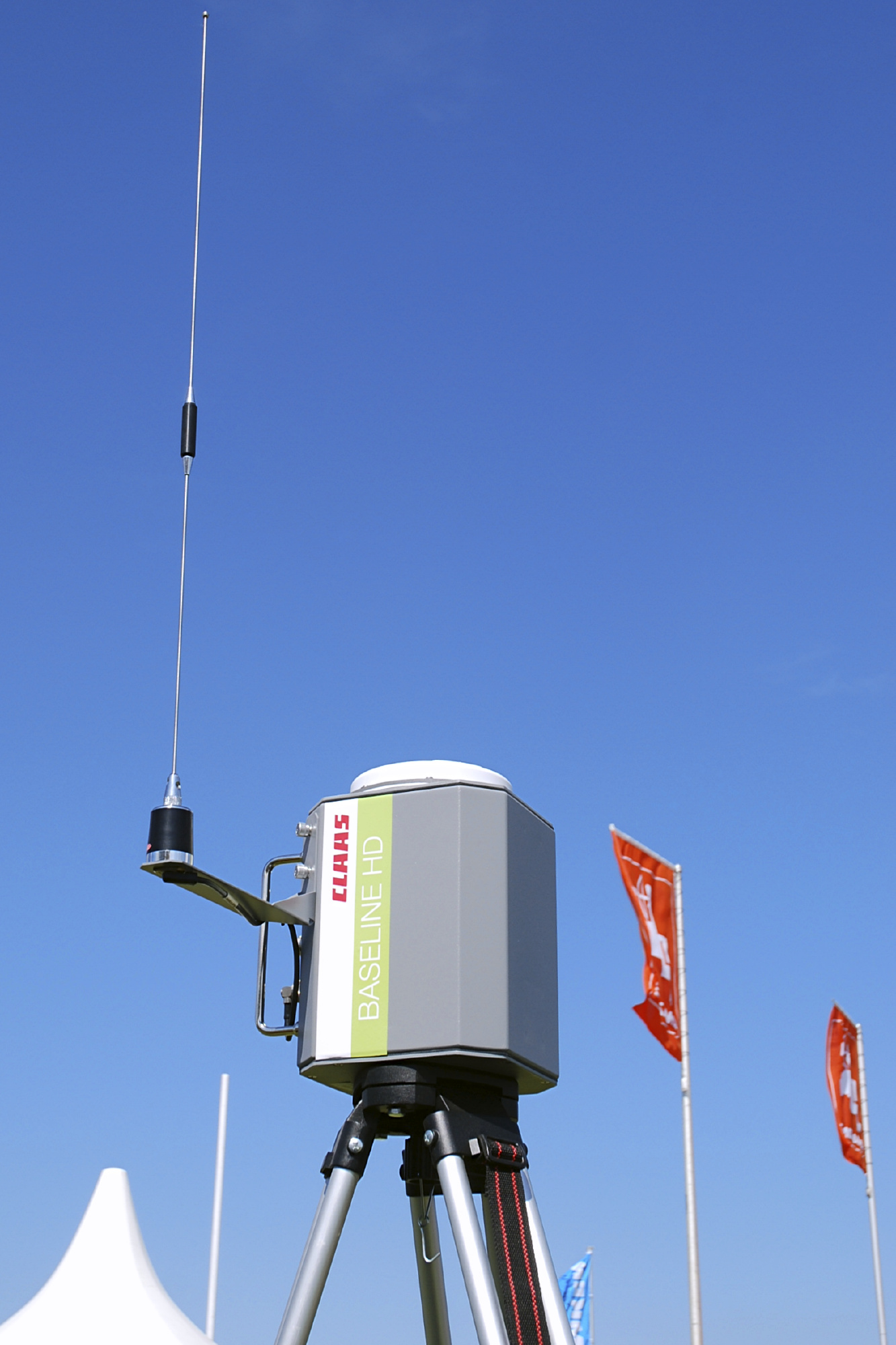
| 14:18, 8 June 2011 | Claas Baseline HD.jpg (file) |  |
555 KB | Wikipedia Image on a Reference Station of DGPS | 1 |
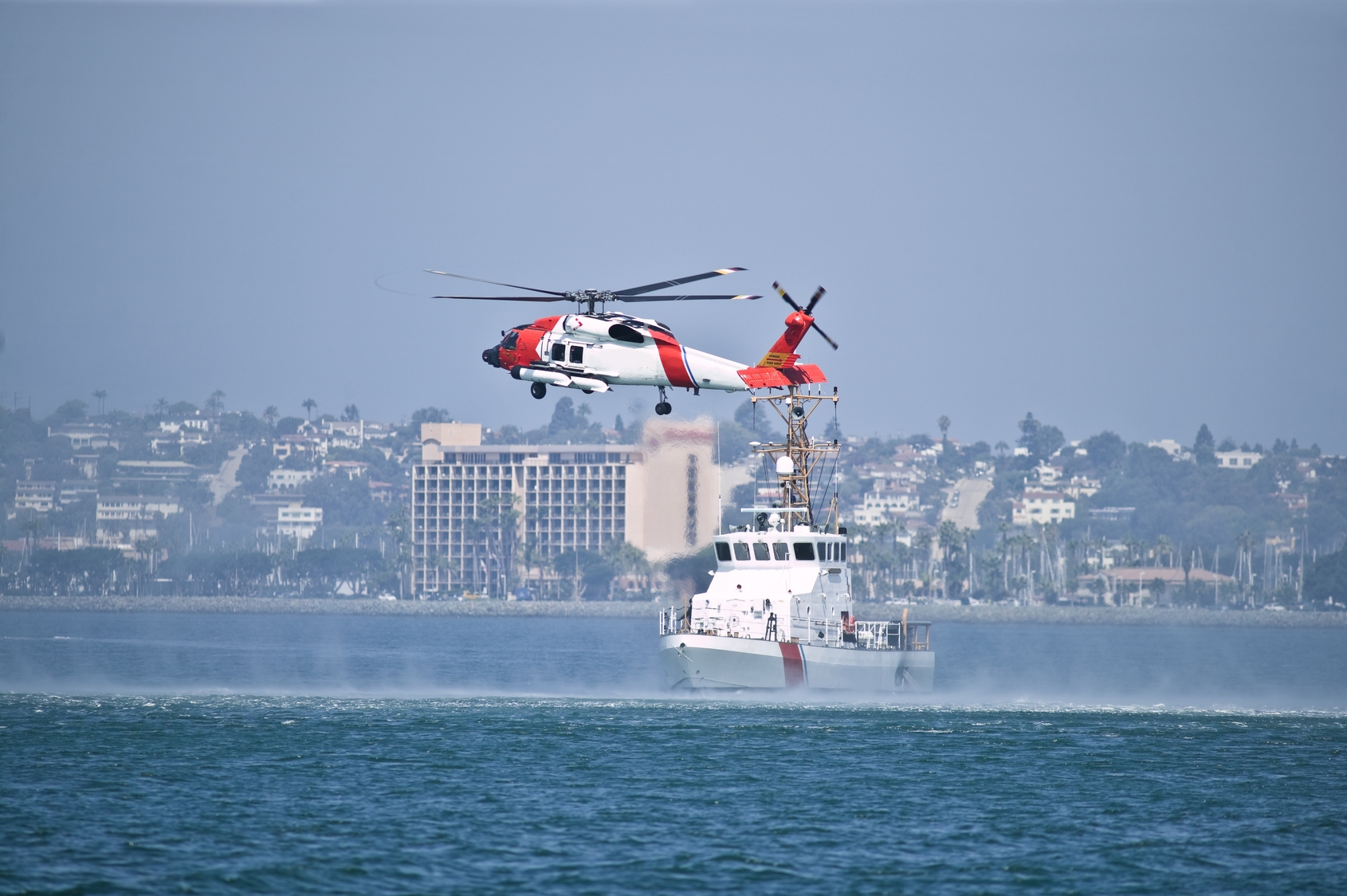
| 16:38, 8 April 2011 | Helicopter and boat.jpg (file) |  |
852 KB | Image for Search and Rescue Service. Taken from European Commision Galileo web page | 1 |
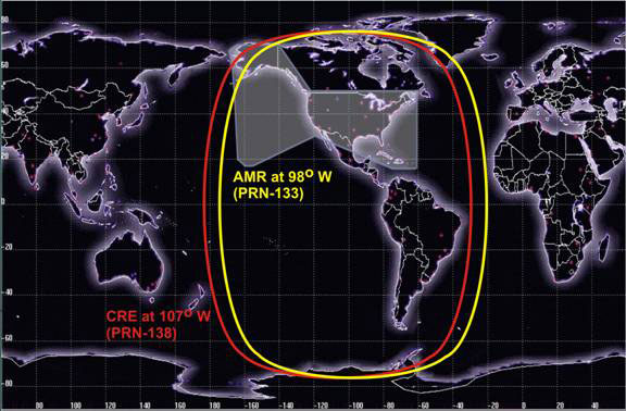
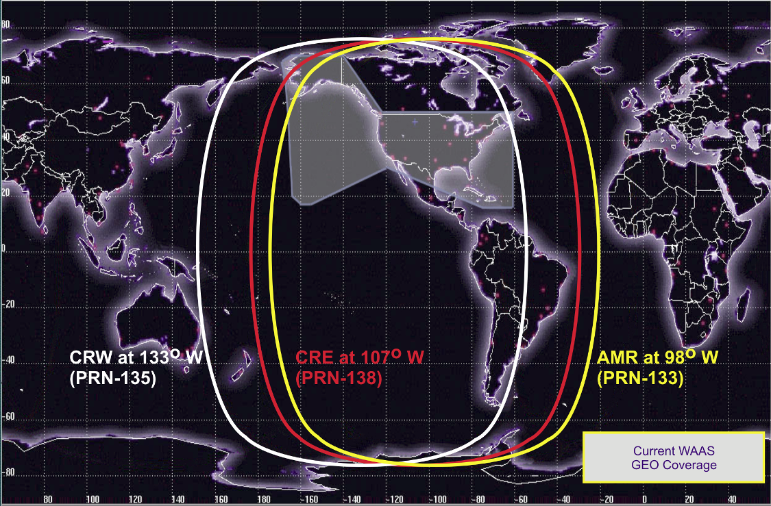
| 11:09, 26 July 2011 | WAASGEOCoverage.PNG (file) |  |
1.39 MB | WAAS GEO Coverage from WAAS Status Presentation (Munich Navigation congress 2011) | 1 |