If you wish to contribute or participate in the discussions about articles you are invited to contact the Editor
File:USDGPS coverage.jpg
Jump to navigation
Jump to search
No higher resolution available.
USDGPS_coverage.jpg (725 × 560 pixels, file size: 139 KB, MIME type: image/jpeg)
Summary
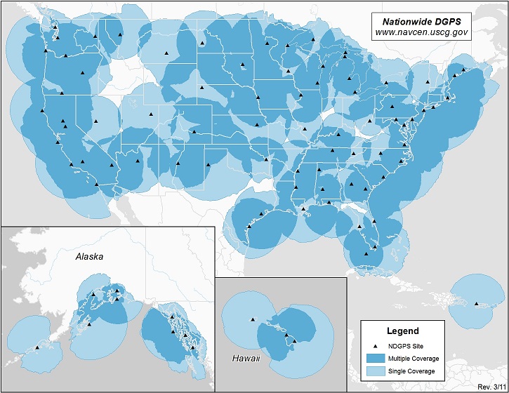
US DGPS Coverage map. Taken from Navigation Center of US Coast Guard: http://www.navcen.uscg.gov/
Licensing
File history
Click on a date/time to view the file as it appeared at that time.
| Date/Time | Thumbnail | Dimensions | User | Comment | |
|---|---|---|---|---|---|
| current | 14:46, 8 June 2011 | | 725 × 560 (139 KB) | Irene.Hidalgo (talk | contribs) | US DGPS Coverage map. Taken from Navigation Center of US Coast Guard |
You cannot overwrite this file.
File usage
The following page uses this file: