If you wish to contribute or participate in the discussions about articles you are invited to contact the Editor
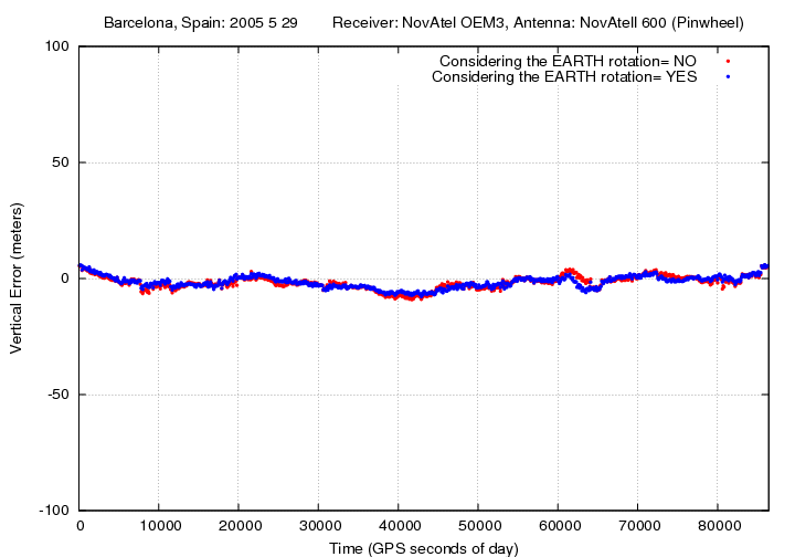
File:Geom Range Modell Sat Coord Computation V Nov rot.png
Jump to navigation
Jump to search
No higher resolution available.
Geom_Range_Modell_Sat_Coord_Computation_V_Nov_rot.png (720 × 504 pixels, file size: 32 KB, MIME type: image/png)
Geom_Range_Modell_Sat_Coord_Computation_V_Nov_rot.png
File history
Click on a date/time to view the file as it appeared at that time.
| Date/Time | Thumbnail | Dimensions | User | Comment | |
|---|---|---|---|---|---|
| current | 10:24, 1 April 2011 | | 720 × 504 (32 KB) | Carlos.Lopez (talk | contribs) | Geom_Range_Modell_Sat_Coord_Computation_V_Nov_rot.png |
You cannot overwrite this file.
File usage
The following page uses this file: