If you wish to contribute or participate in the discussions about articles you are invited to contact the Editor
File:GPS infrastructure.png
Jump to navigation
Jump to search
No higher resolution available.
GPS_infrastructure.png (610 × 423 pixels, file size: 108 KB, MIME type: image/png)
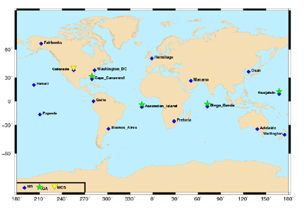
GPS ground infrastructure (source: J. Sanz Subirana, JM. Juan Zornoza and M. Hernández-Pajares, Global Navigation Satellite Systems: Volume I: Fundamentals and Algorithms)
File history
Click on a date/time to view the file as it appeared at that time.
| Date/Time | Thumbnail | Dimensions | User | Comment | |
|---|---|---|---|---|---|
| current | 15:52, 31 March 2011 | | 610 × 423 (108 KB) | Jose.Caro (talk | contribs) | GPS ground infrastructure (source: J. Sanz Subirana, JM. Juan Zornoza and M. Hernández-Pajares, ''Global Navigation Satellite Systems: Volume I: Fundamentals and Algorithms'') |
You cannot overwrite this file.
File usage
The following page uses this file: