If you wish to contribute or participate in the discussions about articles you are invited to contact the Editor
File:DGPS AustraliaCoverageMap.gif
Jump to navigation
Jump to search

No higher resolution available.
DGPS_AustraliaCoverageMap.gif (585 × 426 pixels, file size: 10 KB, MIME type: image/gif)
Summary
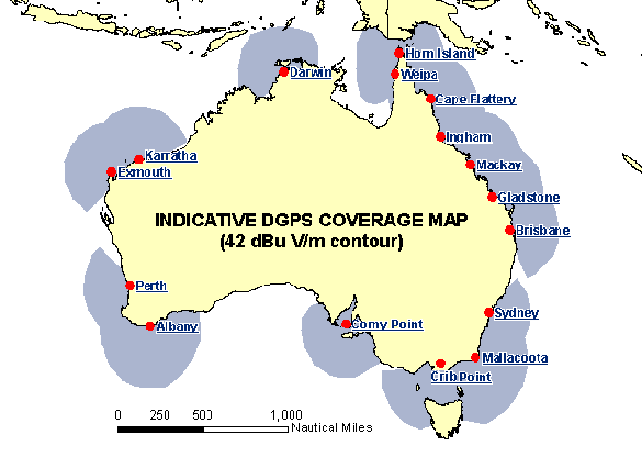
Australia DGPS System, Coverage Map taken from Australian Maritime Safety Authority webpage.
Licensing
{{subst:No license from license selector|Don't know}}
File history
Click on a date/time to view the file as it appeared at that time.
| Date/Time | Thumbnail | Dimensions | User | Comment | |
|---|---|---|---|---|---|
| current | 14:28, 8 June 2011 | | 585 × 426 (10 KB) | Irene.Hidalgo (talk | contribs) | Australia DGPS System, Coverage Map taken from Australian Maritime Safety Authority webpage. |
You cannot overwrite this file.
File usage
There are no pages that use this file.