If you wish to contribute or participate in the discussions about articles you are invited to contact the Editor
Category:GPS
| This category uses the form xxx. |
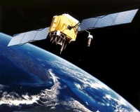
DescriptionThe GPS is a space-based global navigation satellite system (GNSS) that provides reliable positioning, navigation, and timing services to civilian and military users on a continuous worldwide basis -- freely available to all. It is maintained by the United States government and is freely accessible by anyone with a GPS receiver. GPS receivers compute their position in the GPS Reference System using satellite technology and based on triangulation principles GPS was originally developed for the U.S. military, but is now provided as a public service for people all over the world by the U.S. government. Deployment of the GPS system began on 22 February 1978 with the launch of the first Block I Navstar GPS satellite. Initial Operating Capability was declared in December 1993 with 24 operational GPS satellites in orbit. Full Operational Capability was declared in June of 1995. Related articlesFor a detailed description of GPS, please visit the following links: |
Subcategories
This category has the following 10 subcategories, out of 10 total.
F
- GPS Future and Evolutions (1 P)
G
- GPS Space Segment (1 P)
- GPS Ground Segment (1 P)
I
- GPS Interoperability (1 P)
P
- GPS Performance (1 P)
R
- GPS Receivers (2 P)
- GPS Reference Systems (1 P)
S
- GPS Services (1 P)
- GPS Signal Structure (2 P)
U
- GPS User Segment (1 P)
Pages in category "GPS"
The following 14 pages are in this category, out of 14 total.

