If you wish to contribute or participate in the discussions about articles you are invited to contact the Editor
Surveying, Mapping and GIS Applications
| Applications | |
|---|---|
| Title | Surveying, Mapping and GIS Applications |
| Author(s) | GMV. |
| Level | Medium |
| Year of Publication | 2011 |
One of the most obvious uses for GNSS systems is the realization of surveys and production of maps. Although a simple standalone GNSS Receiver might not have the required precision for some survey requirements, most of these requirements can be fulfilled using high-end dual frequency multi-constellation receivers built specifically for surveying and by using GNSS Augmentation techniques.
The use of GNSS techniques in geodesy have revolutionized the way geodetic measurements are made. An increasing number of national governments and regional organizations are using GNSS measurements as the basis for their geodetic networks[1].
Land Surveying
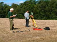
Land Surveying is a technique and science of accurately measuring the distances and angles between different points, on the surface of Earth. GNSS has been used by land surveyors since the late 1980s, primarily for geodetic control networks and for photo control[2].
Nowadays, GNSS is used to determine precise locations all over the globe, in any weather conditions and at any time of the day. GNSS geodetic surveying equipment has become smaller and easier to use being faster to use than other surveying methods. GNSS is specially used for large topographic surveys where a centimeter level accuracy is enough[3].
Detailed information about Land Surveying can be found here.
Mapping & GIS
Mapping and GIS applications allow to capture, store, manipulate, analyze, manage, and present all types of geographically referenced data[4]. GIS technology combines database, mapping and statistical methods to integrate georeferenced data into visual displays where the relationships, patterns and trends in the data can be more easily identified[5].
Although Mapping and GIS applications do not rely on GNSS as sole means for data capture, the widespread of the GNSS technologies has allowed for low-cost data acquisition processes that made GIS technologies to be more generally used.
Detailed information about Mapping & GIS can be found here.
Deformation Monitoring
Detailed information about Deformation Monitoring can be found here.
Maritime Surveying
Detailed information about Maritime Surveying can be found here.
Aerial Surveys
Laser profiling from helicopters, carrying special electromagnetic sensors, which allow thickness estimates to be made of individual ice floes, will examine ice properties. Alternatively, ice core drilling and subsequent laboratory analysis may be carried out[6].
Aircrafts with radar and laser altimeters can measure ice sheet profiles[7].
Detailed information about Aerial Laser Profiling can be found here.
Archeology
Detailed information about Archeology can be found here.
Notes
References
- ^ GNSS Follow-up to the Third United Nations Conference on the Exploration and Peaceful Uses of Outer Space (UNISPACE III) - Report of the action team on Global Navigation Satellite Systems (GNSS), UN, ST/SPACE/24, 2004.
- ^ Guidelines for the use of GNSS in land surveying and mapping, Royal Institution of Chartered Surveyors (RICS), Practice Standards, 2010
- ^ Surveying on Wikipedia
- ^ Geographic information system in Wikipedia
- ^ What is GIS?, gis.com
- ^ Strategies for Calibrating and Validating CryoSat now underway, ESA Portal, October 2002
- ^ Strategies for Calibrating and Validating CryoSat now underway, ESA Portal, October 2002


