If you wish to contribute or participate in the discussions about articles you are invited to contact the Editor
File:GPS ground segment.png
No higher resolution available.
GPS_ground_segment.png (512 × 440 pixels, file size: 63 KB, MIME type: image/png)
File history
Click on a date/time to view the file as it appeared at that time.
| Date/Time | Thumbnail | Dimensions | User | Comment | |
|---|---|---|---|---|---|
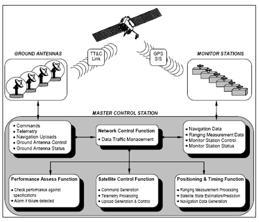
| current | 15:37, 31 March 2011 | | 512 × 440 (63 KB) | Jose.Caro (talk | contribs) | The GPS Operational Control System (OCS) (source: SPS Standard) |
You cannot overwrite this file.
File usage
The following page uses this file: