If you wish to contribute or participate in the discussions about articles you are invited to contact the Editor
Space Applications
| Applications | |
|---|---|
| Title | Space Applications |
| Edited by | GMV |
| Level | Intermediate |
| Year of Publication | 2011 |
GNSS systems were originally designed for earth-based positioning and navigation. Despite this, real-time spacecraft navigation based on spaceborne GNSS receivers is becoming a common technique for low-Earth orbits and geostationary orbits, allowing satellites to self-determine their position using GNSS, reducing dependence on ground-based stations[1].
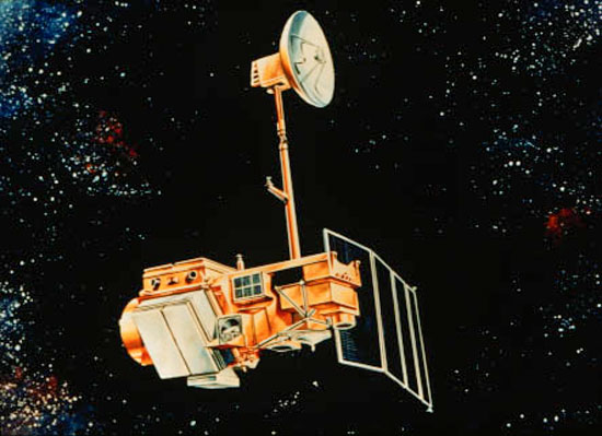
The space community started experimenting with spaceborne receivers very early in the deployment of the GPS network.The first spaceborne GNSS receiver was deployed in Landsat 4 in July 16th 1982. The GPSPAC receiver deployed with Landsat 4 was also deployed with Landsat 5 and 2 other US Department of Defense missions and despite the few number of GPS satellites deployed (at that time only 6 Block I satellites were deployed), the GPSPAC was able to demonstrate the feasibility of using GNSS for space navigation[2].
Operational Constraints of Space-borne Receivers
The space environment presents differences from the terrestrial environment that don't allow us to take the assumption that a receiver working flawlessly on the ground will work properly in space.
Velocity
The first big difference is the spacecraft velocity and specially the bigger relative velocity between the GNSS receiver and the GNSS satellites. Bigger velocity induce bigger Doppler shifts and the receiver will have to scan a larger range of frequencies to acquire the GNSS signal. Also at this velocity the receiver will track each satellite for a shorter period and visible satellites will change faster. This might require a different selection logic and tracking loop design in order to cope with this more dynamic environment. In general this increases the time required for the signal acquisition and some terrestrial receivers are limited by design to work below certain velocities since it is not expected that a terrestrial receiver can achieve the velocities achieved by a spacecraft.
Orbit
Orbit altitude and geometry are also a constraining factor for space-borne receivers. GPS satellites orbit the earth at an altitude of roughly 20 200 km and the GNSS signal is transmitted by directional antennas pointed to earth and taking into account the earth diameter. For Low Earth Orbit[footnotes 1] spacecrafts the signal reception conditions are roughly the same as in terrestrial applications. When progressing in Medium Earth Orbit until near the altitude of the GPS satellites signal acquisition becomes increasingly more difficult since it is more likely that the spacecraft will fall outside the coverage cone of the GPS satellite signal and might require to track weaker signals from the sidelobes of the satellite or to track satellites on the opposite side of the earth not being obstructed by it. For Medium Earth Orbit above the GPS satellites orbit, High Earth Orbit or High Elliptical Orbits the problem becomes even more harsh since only the weaker signals from the sidelobes and the signal from satellites in the opposite side of earth are available.
Antena
Usually terrestrial receivers antennas have a hemispherical reception pattern since the GNSS signals will come from the sky and ground based vehicle and even aircrafts rarely bank more than 45 degrees[3]. For space-borne vehicles the reception needs to be omni directional with the exception of particular cases where the spacecraft's attitude is somehow stabilized in relation to the GNSS constellation. To achieve omnidirectional reception the most common approach is the use of multiple antennas although other solutions such as modifying the antenna gain pattern can also be used. While space doesn't generally present external sources of signal reflection causing multipath, multipath can be self-induced by the reflection on the spacecraft surface. Also in docking maneuvers or formation flying there might be problems due to multipath due to the reflection of the GNSS signal on the other spacecrafts surfaces. This might have an impact on antenna placement and mitigation techniques could be required.
Footprint
As any spaceborne device, spaceborne devices have very strict constraints in what regards size, shape, weight, power consumption and overall robustness to the space environment. Space GNSS receiver should be as small and light as possible and should have a reduced power consumption. Shape constraints might be different from mission to mission and the receiver should be robust enough to survive the vibration load on liftoff and eventually re-entry. Space receivers should be able to withstand ionizing radiations between 9 to 100 or more kilorads.
Precise Orbit Determination
One of the first scientific applications of GNSS was to precisely determine the position of fixed ground antennas in order to study the dynamics of the Earth surface. It was soon realised that in order to obtain the best results it would be necessary to compute very precise orbits of the GPS satellites. A number of groups started doing this and, as a result, the first orbits that were precisely obtained using GNSS were those of the GPS satellites themselves[4].
Detailed information about Precise Orbit Determination can be found here.
From the very beginning it was realized that GNSS systems could also be used for a wide range of scientific and other civil applications. New tracking methods that were not foreseen by the original developers of the systems, like carrier tracking, were proposed and, as soon as it was possible, successfully tested and used. One of the applications that was soon envisioned was the use of GPS for navigation of spacecraft. The first onboard receiver was installed and flown in a Landsat satellite even before the complete GPS constellation was deployed. Since that time, more receivers have been flown on satellites, at first as a demonstration of increasingly precise uses and now as the main operational means of navigation[4].
Detailed information about Satellite Realtime Navigation can be found here.
Satellite Formation Flying
All space missions are difficult. Docking a pair of spacecraft is tough but flying multiple satellites together in formation is the real cutting edge. In formation flying separate expensive pieces of hardware, each one zipping through space at several kilometres per second, may have to manoeuvre to within metres of each other to achieve their goals[5].
The relative positions of the satellites must be maintained precisely as they close in: lose control of one part of the formation, even momentarily, and the satellites risk destruction. And orbital dynamics dictate the satellites’ orbits will tend to cross as they circle Earth, another worrying factor for their controllers[5].
Detailed information about Satellite Formation Flying can be found here.
Notes
- ^ between 160 and 2,000 km altitude
References
- ^ Innovative satellite navigation receivers for space applications, ESA Portal, February 16th 2006
- ^ Landsat-4 and -5, eoPortal
- ^ GNSS Applications and Methods - Chapter 13 - Space Applications, E. Gleen Lightsey, Artech House
- ^ a b Satellite Navigation Using GPS, T.J. Martín Mur & J.M. Dow, ESA Bulletin Nr. 90, May 1997
- ^ a b Simulating the formation-flying future of space, ESA Portal, September 2010


