If you wish to contribute or participate in the discussions about articles you are invited to contact the Editor
GLONASS User Segment
| GLONASS | |
|---|---|
| Title | GLONASS User Segment |
| Author(s) | GMV |
| Level | Basic |
| Year of Publication | 2011 |
The GLONASS User Segment consists on L-band radio receiver/processors and antennas which receive GPS signals, determine pseudoranges (and other observables), and solve the navigation equations in order to obtain their coordinates and provide a very accurate time.
GLONASS Receivers
A GLONASS Receiver is a device capable of determining the user position, velocity and precise time (PVT) by processing the signal broadcasted by satellites.
Any navigation solution provided by a GNSS Receiver is based on the computation of its distance to a set of satellites, by means of extracting the propagation time of the incoming signals traveling through space at the speed of light, according to the satellite and receiver local clocks.
Notice that satellites are always in motion, so previous to obtaining the navigation message, the satellite’s signal is detected and tracked. The receiver’s functional blocks that perform these tasks are the antenna, the front-end and the baseband signal processing (in charge of acquiring and tracking the signal).
Once the signal is acquired and tracked, the receiver application decodes the navigation message and estimates the user position. The Navigation Message includes:[1]
- Ephemeris parameters, needed to compute the satellite’s coordinates
- Time parameters and Clock Corrections, to compute satellite clock offsets and time conversions
- Service Parameters with satellite health information
- Ionospheric parameters model needed for single frequency receivers
- Almanacs, needed for the acquisition of the signal by the receiver. It allows computing the position of all satellites but with a lower accuracy than the ephemeris
The ephemeris and clocks parameters are usually updated every half-an-hour, whereas the almanac is updated at least every six days.
For more information, please refer to GLONASS Interface Control Document [2] which specifies parameters of interface between GLONASS space segment and user equipment in L1 and L2 Bands
Commercial use
Although the GLONASS constellation is nearing global coverage, its commercialisation, especially development of the user segment, has been lacking compared to the American GPS system.[3]
To improve the situation, the Russian government has been actively promoting GLONASS for civilian use. In February, the government announced that all passenger cars, large transport vehicles and vehicles transporting dangerous materials will be required to use GLONASS-equipped navigators as of July 2011.[4] The tracking of this road traffic will be tied to road tax collection as well as to a roadside assistance in the event of an accident. The tracking system, known as ERA, will begin testing in July 2011, with transponders becoming mandatory in all vehicles by 2014.[5] As well, the government is planning to force all car manufactures in Russia to make cars with GLONASS starting from 2011. This will affect all car makers, including foreign brands like Ford and Toyota, which have car assembling facilities in Russia.[3]
Commercial response to GLONASS improved accuracy is gaining momentum, with several recent announcements that include:
- Qualcomm has announced support for the Russian GLONASS satellite positioning system with a chipset that means receivers can use both the GPS and GLONASS networks simultaneously for greater location performance in their phones.
- On February 2, ST-Ericsson launched “the world’s smallest receiver” to connect to both GPS and Glonass satellites.
- Broadcom, a global leader in semiconductors, announced new solutions to add Glonass to the constellation of satellites available for navigation.
- In April 2011, Sweden’s Swepos became the first foreign company to use Russia’s GLONASS positioning technology, due to Swepos’ conviction that it is better than GPS at northern latitudes.
Applications
GLONASS applications are all those applications that use GLONASS to collect position, velocity and time information to be used by the application. Global navigation and time synchronization service of unlimited number of users on ground, on sea, airborne and in space. Access to civilian signal of the system is provided to Russian and foreign users free of charge and withour any restrictions:[6]
- Armed Forces
- Communication and energy systems synchronization
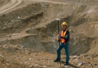
- Geodesy: GLONASS and GLONASS\GPS receivers are used to determine precise coordinates of points and land parcel boundaries
- Cartography: GLONASS is used in civilian and military cartography
- Tectonics: tectonic plates movements and convulsions are tracked using satellites
- Navigation: global positioning systems are used for maritime and roadway navigation
- Satellite monitoring: ERA-GLONASS project is motor vehicle position and velocity monitoring and control over their movements
- Complex engineering structures monitoring
- Animals monitoring, environmental protection
- Search and rescue facilitation
- Personal trackers, "panic button"
Notes
References
- ^ J. Sanz Subirana, JM. Juan Zornoza and M. Hernández-Pajares, Global Navigation Satellite Systems: Volume I: Fundamentals and Algorithms
- ^ GLONASS Interface Control Document, Edition 5.1
- ^ a b GLONASS on Wikipedia
- ^ [ http://vikno.eu/eng/avto/avto/ministry-of-transport-wants-to-fine-for-absence-of-navigators-glonass.html Ministry of transport want to fine for absence of GLONASS navigators]
- ^ [ http://www.asmmag.com/features/feature/russia-accelerates-glonass-navigation-satellite-launches-02061472 Russia accelerates GLONASS Navigation Satellite launches]
- ^ GLONASS Applications on spacecorp.ru


