If you wish to contribute or participate in the discussions about articles you are invited to contact the Editor
Phones: Difference between revisions
No edit summary |
|||
| Line 79: | Line 79: | ||
* Google: Android market (more than 30,000 applications) | * Google: Android market (more than 30,000 applications) | ||
* Nokia: Ovi Store | * Nokia: Ovi Store | ||
== Notes == | == Notes == | ||
Revision as of 17:58, 23 April 2011
| Applications | |
|---|---|
| Title | Phones |
| Author(s) | Rui Barradas Pereira. |
| Level | Basic |
| Year of Publication | 2011 |
With the advent of smarthphones, many of mobile phone devices are now equipped with GNSS receivers and many more are offering the possibility to use GNSS information within its applications.
By bringing the Assisted GPS (A-GPS) technology into mobile phone, these devices can offer a powerful service in terms of reception, coverage and time to find the first valid GNSS position, making the use of this equipments specially important for emergency situations, but also for navigation in highly construction areas or dense forests[1].
Product Description
A GNSS cell phone is phones with satellite navigation technology embedded which is meant to allow the users to own the same GNSS device features available in equipments such as handheld outdoor receivers, or sport watches, compiled into a single smartphone device.
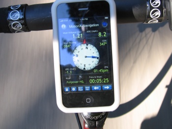
The users may experiment two fundamental needs for using a cell phone with GNSS receiver integrated. The former is the use of the cell phone for navigation, while the person is driving, for road navigation purposes. The later is the pedestrian navigation, where the user needs an equipment which combines cell phone and GNSS handheld device for hiking activities. Concering pedestrian navigation, the cell phones are often used for navigation in cities, or for sport activities because the devices can possess the same type of functionality available in products like sport watches.
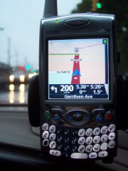
In order to use for automobile navigation the user may establish a subscription to a GNSS navigation service, which will imply a monthly cost addressed, depending of the chosen plan. This service option requires a dependency of the GPRS coverage. Another option available in the market is through the acquisition of a software package which include all the functionality and maps installed in the phone device, without the need to pay a monthly subscription fee, unless the user intents to access enhanced data such as weather or traffic information. This service option does not require a dependency of the GPRS coverage[2]. Nowadays, not only the cell devices, but also tablet PCs or palm PDAs are provided with enough memory and processing resources to hold any kind of navigation software and map features. In terms of navigation capabilities these devices become as powerful as any dedicated GNSS navigation device.
Although, using a GNSS enabled cell phone is not exactly the same as the handheld outdoor receivers used in hiking or pedestrian navigation activities. Most of cell phones do not allow the user to directly access the GNSS information. The phones require a network connection and a service plan[3]. Some applications may also have to be purchased from the network provider or any other vendor.
Product Characterization
The automobile route navigation, will require large storage capabilities to cope with maps. Modern cell phones are now able to deal with these requirements, due to the lower cost of memory cards and to constant improvement in processing capabilities.
Although, some services are able load maps on request, i.e., the user establish a communication with a server, which provide the necessary maps. With this approach the devices reduce the amount of memory needed and guarantee up-to-date map data to the user[1].
Another important characteristic provided by some models is the location-aware content functionality, which implies a recognition capability allowing to get context information about the any location and the integration of spatial position with other phone applications such as calendar, contacts, emails, browser, and messaging [4].
The GNSS functions can also support location services such as mobile locator which can provide tracking capability. This is a feature dependent of the phone equipment, the network provider and the chosen service plan. A tracking option available is the Geofencing, which is the definition of areas where the tracking mechanism can be activated if the equipment enters or exits the defined area. By consequence, the tracking user can receive an alert email or text message. The real time tracking is another network provider option, which provides the capability for the tracking user to track someone, e.g., an employee or relative, through a website[3].
Product Examples
There are currently many operating systems with GNSS hardware support, such as Windows Phone 7, Symbian or Android.
Many manufacturers are now producing equipments with GNSS technology enabled. As result many cell phones models equipped with GNSS are being spread to the common user, mostly by the following companies [5]:
Many vendors also possess software applications to manage maps, find locations, getting directions, tracking other devices, or any types of navigation. These utilities are allowing to put several of the GNSS capabilities, which were distributed among many other devices, embedded into a single personal smartphone.
Among the map providers, there are the global and regional based providers[6]:
Global map providers:
Some of the regional map providers:
Major stores:
- Apple: App store (more than 200,000 applications)
- Google: Android market (more than 30,000 applications)
- Nokia: Ovi Store
Notes


