If you wish to contribute or participate in the discussions about articles you are invited to contact the Editor
WAAS Services: Difference between revisions
Carlos.Lopez (talk | contribs) No edit summary |
Carlos.Lopez (talk | contribs) No edit summary |
||
| Line 1: | Line 1: | ||
{{Article Infobox2 | {{Article Infobox2 | ||
|Category=WAAS | |Category=WAAS | ||
|Editors=GMV | |Editors=GMV | ||
|Level=Basic | |Level=Basic | ||
|YearOfPublication=2011 | |YearOfPublication=2011 | ||
Revision as of 11:14, 23 February 2012
| WAAS | |
|---|---|
| Title | WAAS Services |
| Edited by | GMV |
| Level | Basic |
| Year of Publication | 2011 |
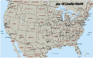
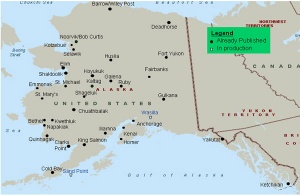
The Wide Area Augmentation System (WAAS) is the United States Satellite Based Augmentation System. The programme, started in 1992, is being carried out by the Federal Aviation Agency (FAA)[1] and is specially developed for the civil aviation community.[2] The system, which was declared operational in late 2003,[3] currently supports thousands of aircraft instrument approaches in more than one thousand airports in USA and Canada.[4] WAAS service area includes CONUS, Alaska, Canada and Mexico.[5] The WAAS programme is continuously in evolution; two development phases have been already covered, a third is in progress, and there are plans to improve the capability of the system in parallel with the evolution of the SBAS standards towards a dual-frequency augmentation service.[6]
WAAS Services
The objectives of the WAAS are to provide improved integrity, accuracy, availability, and continuity of service to the GPS Standard Positioning Service (SPS) for the Civil Aviation community. The ultimate objective is to provide a navigation system for all phases of flight through precision approach.[7]
The WAAS is a safety-critical system which augments Global Positioning System (GPS) Standard Positioning Service (SPS). The WAAS provides a signal-in-space to WAAS users, i.e. all aircraft with approved WAAS avionics, to support en route through precision approach navigation. The WAAS GEO satellites have ranging capabilities, i.e., they can be used as extra GPS satellites to enhance the performance achieved in the user location because of the additional statistics and the improved geometry. In addition, the WAAS signals broadcast augmentation information that corrects GPS ephemeris and ensures the integrity meeting the WAAS performance requirements.[7]
In order to take benefit from the signal in space provided by WAAS, aircraft need to be equipped with certified receivers meeting the corresponding standards, i.e. RTCA MOPS DO 229 (see article SBAS Standards).
On July 10, 2003, the WAAS system was declared operational for safety-of-life aviation, with a service area consisting in 95% of the United States, and part of Alaska,[3][8] to be expanded in 2007 to include Canada and Mexico.[6] At present, WAAS supports en-route, terminal and approach operations down to a full LPV-200 (CAT-I like Approach Capability) for the WAAS service area that includes CONUS, Alaska and Canada.[4][5]
Currently, WAAS supports the following flight procedures:[4][9]
- LNAV (Lateral Navigation).
- LNAV/VNAV (Lateral Navigation/Vertical Navigation).
- LP (Localizer Performance).
- LPV (Localizer Performance with Vertical guidance).
Notes
References
- ^ Navigation Services - History - Satellite Navigation, FAA.
- ^ Navigation Services - Wide Area Augmentation System (WAAS), FAA.
- ^ a b Wide Area Differential GPS (WADGPS), Stanford University
- ^ a b c GNSS - GPS/WAAS Approaches, Federal Aviation Agency (FAA).
- ^ a b WAAS Service Expanded into Canada and Mexico, September 28, 2007, Federal Aviation Agency (FAA).
- ^ a b SatNav News, Vol. 33, March 2008, Federal Aviation Agency (FAA).
- ^ a b Specification for the Wide Area Augmentation System(WAAS), FAA-E- 2892b, August 13, 2001.
- ^ Wide Area Augmentation System in Wikipedia
- ^ Aviation Glossary


