If you wish to contribute or participate in the discussions about articles you are invited to contact the Editor
Autonomous Flying: Difference between revisions
m (Text replace - "|Authors=GMV." to "|Authors=GMV") |
|||
| Line 2: | Line 2: | ||
|Category=Applications | |Category=Applications | ||
|Title={{PAGENAME}} | |Title={{PAGENAME}} | ||
|Authors=GMV | |Authors=GMV | ||
|Level=Medium | |Level=Medium | ||
|YearOfPublication=2011 | |YearOfPublication=2011 | ||
Revision as of 13:46, 1 November 2011
| Applications | |
|---|---|
| Title | Autonomous Flying |
| Author(s) | GMV |
| Level | Medium |
| Year of Publication | 2011 |
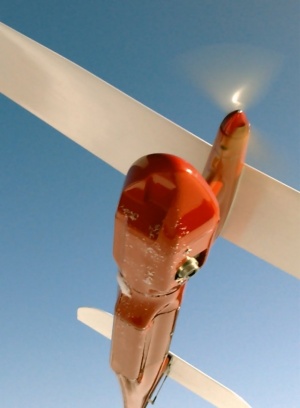
Advanced UAVs (Unmanned Aerial Vehicles) are used or proposed in many missions covering security (including border patrol, anti-drug warfare, chemical, biological and radiological detection, maritime vessel identification and interdiction), surveillance of infrastructures (pipelines, power lines, railways, waterways, roads, airports), search and rescue, mapping, fisheries, agriculture, forestry, natural resource monitoring, fire fighting and emergency management, airborne communication collection and relay, weather data collection, environmental monitoring, pollution detection and other scientific research[1].
GNSS plays a very important role in UAVs. Either in when guided autonomously or guided by ground-based pilots, GNSS is used for determination of the location and speed of the UAV either for navigation or georeferencing the collected data. If the vehicle is autonomous, GNSS can contribute actively to the control loop of the UAV by providing inputs to the control algorithm and by giving feedback to the control algorithm after an action is taken.
Application Architecture
The characteristics and installation of the GNSS receivers in UAVs can vary with the type of UAV and how the the UAV uses the GNSS information. For larger UAVs the equipment and installation can be similar to the equipment used in conventional aircrafts (except for the user interface). For smaller UAVs there might be the need to have tailored GNSS receivers based on existing off-the-shelf equipment due the reduced size of the aircraft.
Typically the installation will consist of one antenna installed on the upper part of the aircraft connected to the receiver that is then connected to the avionics of the UAV where the GNSS data can be integrated with other sensors data. If GNSS data is used for attitude determination a multiple antenna configuration might be in-place usually with up to 3 antennas usually installed on the tip of the wings and on the tail.
Application Characterization
In UAVs, GNSS can be used for 4 different types of applications[2]:
- Navigation - The use of GNSS in the navigation of UAV is similar to the use in manned aerial vehicle navigation. Two main differences can be observed:
- Safety requirements are less stringent since the loss of the vehicle doesn't imply the loss of human lives or injuries. Anyhow safety requirements must still be taken into account as described below.
- In autonomous UAVs, GNSS is part of the control loop of the guidance algorithm, although other sources such as cameras, inertial sensors are normally used and combined by filters with GNSS data to guide the vehicle.
- Attitude Determination - Attitude determination can be used by UAVs in the same way as in manned aerial vehicle attitude determination
- Georeferencing data - As described, UAVs can be used for a numerous type of activities. The main type of payload is earth observation payload to conduct aerial surveys where different techniques (cameras, radars, lidars,...) are used to monitor or collect information from the earth surface. For this information to be useful needs to be georeferenced and this is normally done using GNSS.
- Safety - Although self-preservation is less relevant in an unmaned aerial vehicle is still very important that UAVs don't interfere with maned vehicles and that don't cause loss of lives or property damage when they land or crash. Therefore the use of ADS-B transponders on UAVs will allow traffic controllers, other UAVs and maned aerial vehicles to be aware of their presence.
Application Examples
The number of UAVs in operation is too big to list here[3]. Most of the UAVs currently on operation uses GNSS.
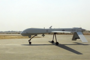
Some of the most known UAVs due to its involvement in the US operations in Afghanistan and Iraq are the Predator B and its successor the Reaper.
Notes
References
- ^ Feasibility Study for an Unmanned Aerial System Mission Supported by Integrated Space Systems, ESA Portal, July 2009
- ^ GNSS positioning for UAV Applications, Jan Leyssens, Septentrio
- ^ List of UAVs from Wikipedia


