If you wish to contribute or participate in the discussions about articles you are invited to contact the Editor
Road Products: Difference between revisions
m (Included editor logo.) |
No edit summary |
||
| Line 5: | Line 5: | ||
|YearOfPublication=2011 | |YearOfPublication=2011 | ||
|Logo=GMV | |Logo=GMV | ||
}} | }} | ||
The road sector is a major potential market for GNSS. Satellite navigation receivers are now commonly installed in new cars as a key tool for providing new services to people on the move: electronic charging, real-time traffic information, emergency calls, route guidance, fleet management and Advanced Driving Assistance Systems<ref>[ | The road sector is a major potential market for GNSS. Satellite navigation receivers are now commonly installed in new cars as a key tool for providing new services to people on the move: electronic charging, real-time traffic information, emergency calls, route guidance, fleet management and Advanced Driving Assistance Systems<ref>[https://ec.europa.eu/commission/index_en Galileo Application Sheet - Road Applications], ESA and European Commission, October 2002</ref>. | ||
Satellite navigation will help regulate road use and minimize traffic jams. If all vehicles are fitted with a navigation satellite receiver and a data transmitter, their position can be relayed automatically every few seconds to a central station. This information can then be used in a number of ways to control road usage. It could, for example, be used to charge motorists for using a stretch of road, to restrict access to congested roads, or to inform drivers of congestion and suggest alternative, quieter routes<ref>[http://www.esa.int/esaMI/Navigation_Applications/SEM9RFEVL2F_0.html ESA Portal - Navigation Applications - Road], ESA, June 2007</ref>. | Satellite navigation will help regulate road use and minimize traffic jams. If all vehicles are fitted with a navigation satellite receiver and a data transmitter, their position can be relayed automatically every few seconds to a central station. This information can then be used in a number of ways to control road usage. It could, for example, be used to charge motorists for using a stretch of road, to restrict access to congested roads, or to inform drivers of congestion and suggest alternative, quieter routes<ref>[http://www.esa.int/esaMI/Navigation_Applications/SEM9RFEVL2F_0.html ESA Portal - Navigation Applications - Road], ESA, June 2007</ref>. | ||
Latest revision as of 19:26, 16 September 2018
| Applications | |
|---|---|
| Title | Road Products |
| Edited by | GMV |
| Level | Intermediate |
| Year of Publication | 2011 |
The road sector is a major potential market for GNSS. Satellite navigation receivers are now commonly installed in new cars as a key tool for providing new services to people on the move: electronic charging, real-time traffic information, emergency calls, route guidance, fleet management and Advanced Driving Assistance Systems[1].
Satellite navigation will help regulate road use and minimize traffic jams. If all vehicles are fitted with a navigation satellite receiver and a data transmitter, their position can be relayed automatically every few seconds to a central station. This information can then be used in a number of ways to control road usage. It could, for example, be used to charge motorists for using a stretch of road, to restrict access to congested roads, or to inform drivers of congestion and suggest alternative, quieter routes[2].
Overview of Road Products
The GNSS Market is currently dominated by two kinds of products: Personal Navigation Devices and Vehicle Trackers.
While Personal Navigation Devices are oriented for navigation, Vehicle Trackers are oriented towards logistics and fleet management. Personal Navigation Devices are driver oriented having rich user interfaces and not requiring communications. Vehicle Trackers are server oriented requiring communications with a central server and might not have user interface at all.
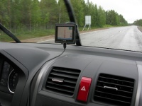
Personal Navigation Devices (PND) are portable devices specifically built to run Road Navigation applications. This product is one the most popular product with embedded GNSS technology followed by GNSS-enabled smartphones. PNDs are becoming redundant with increasing use of smartphones and better affordability of In-Vehicle Systems (IVS). In fact with smartphone navigation becoming increasingly popular, the PND market has been declining since 2009, according to the GNSS Market Report, Issue 3.
These products that initially only supported navigation now incorporate other functionality such as mobile hands-free system, multimedia player, games, external application support, travel utilities (world time, currency converter, measurement converter, calculator, etc).
Detailed information about Personal Navigation Devices can be found here.
Vehicle Trackers
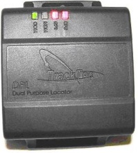
Vehicle Trackers are devices attached to the vehicle that track the vehicle position usually for monitoring purposes. These devices can be used for different purposes such as logistics, theft prevention/recovery, emergency services, tolling and driver behavior monitoring. Besides these applications, that require little interaction with the driver, these devices can be connected to other in-car systems either to provide position or to collect additional vehicle information from other vehicle sensors. It is not uncommon that these device are connected to the communication and entertainment system to provide positioning for interactive services such as navigation.
These devices can be passive when wide area communications are not supported and the data collected in the device is analyzed at the end of the trip. But usually these devices are active and incorporate wide area communications that is used to send the collected information to a central server or service.
Detailed information about Vehicle Trackers can be found here.
Notes
References
- ^ Galileo Application Sheet - Road Applications, ESA and European Commission, October 2002
- ^ ESA Portal - Navigation Applications - Road, ESA, June 2007


