If you wish to contribute or participate in the discussions about articles you are invited to contact the Editor
Maritime Applications: Difference between revisions
mNo edit summary |
No edit summary |
||
| (17 intermediate revisions by 5 users not shown) | |||
| Line 1: | Line 1: | ||
{{Article Infobox2 | {{Article Infobox2 | ||
|Category=Applications | |Category=Applications | ||
| | |Editors=GMV | ||
|Level=Intermediate | |||
|Level= | |||
|YearOfPublication=2011 | |YearOfPublication=2011 | ||
|Logo=GMV | |Logo=GMV | ||
| Line 9: | Line 8: | ||
According with [[wikipedia:International Maritime Organization|International Maritime Organization (IMO)]], ''Shipping is the most international of all the world's great industries''. In fact a huge number of vessels moves around the world each day, making the efficiency, safety and optimization of marine transportation key issues. | According with [[wikipedia:International Maritime Organization|International Maritime Organization (IMO)]], ''Shipping is the most international of all the world's great industries''. In fact a huge number of vessels moves around the world each day, making the efficiency, safety and optimization of marine transportation key issues. | ||
GNSS technology will be fundamental for bringing innovation and progress in navigation and many other marine activities such as fishing, oceanography and oil and gas exploitation. Satellite navigation benefits all maritime applications, including leisure boats, commercial vessels, and unregulated and Safety of Life at Sea ([[wikipedia:International Convention for the Safety of Life at Sea|SOLAS]]) regulated ships. Each application will take advantage of the new characteristics offered by | GNSS technology will be fundamental for bringing innovation and progress in navigation and many other marine activities such as fishing, oceanography and oil and gas exploitation. Satellite navigation benefits all maritime applications, including leisure boats, commercial vessels, and unregulated and Safety of Life at Sea ([[wikipedia:International Convention for the Safety of Life at Sea|SOLAS]]) regulated ships. Each application will take advantage of the new characteristics offered by GNSS augmentation: increased accuracy and integrity, certified services and high availability.<ref name="ESA-portal">[http://www.esa.int/esaMI/Navigation_Applications/SEMKSFEVL2F_0.html ESA Portal], Maritime Navigation Applications</ref> | ||
GNSS will be used in every phase of marine navigation: ocean, coastal, port approach and port | GNSS will be used in every phase of marine navigation: ocean, coastal, port approach and port manoeuvres, under all weather conditions.<ref name="esa-ec">[https://ec.europa.eu/commission/index_en Galileo Application Sheet - Maritime Applications], ESA and European Commission, October 2002</ref> | ||
== Overview of Maritime Applications == | == Overview of Maritime Applications == | ||
GNSS is used mainly in maritime en route navigation and in support to the AIS and VTS systems which are maritime traffic collision and traffic control mechanisms. | GNSS is used mainly in maritime en route navigation and in support to the AIS and VTS systems which are maritime traffic collision and traffic control mechanisms. | ||
In maritime en route navigation there are two categories of applications, the chart plotters receivers and fish finder applications. | In maritime en route navigation there are two categories of applications, the chart plotters receivers and fish finder applications. | ||
Besides the above mentioned applications, there are several other | Besides the above mentioned applications, there are several other utilizations of GNSS in maritime applications, such as:<ref>[http://galileo.cs.telespazio.it/metis/public/METIS%20Egypt%20Training%20&%20Seminar/Proceedings/5-%20Maritime%20EU%20GNSS%20activities-AIN.pdf GSA METIS], November 2007</ref> | ||
* Observing the changes of sea level, | * Observing the changes of sea level, | ||
* Dredging operations, | * Dredging operations, | ||
* | * Wrecks location, | ||
* Laying pipe lines, | * Laying pipe lines, | ||
* | * Search and Rescue of sinking vessels, | ||
* Dynamic | * Dynamic positioning, | ||
* Positioning of oil rigs and | * Positioning of oil rigs and | ||
* Fixing of | * Fixing of satellite sea launch platforms. | ||
== En Route Navigation == | == En Route Navigation == | ||
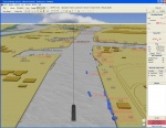
[[File:Tresco_3D_AIS.JPG|right|thumb|150px|En route navigation]] | [[File:Tresco_3D_AIS.JPG|right|thumb|150px|En route navigation]] | ||
Nowadays, ship navigation casualties and incidents can result in serious loss of life and pollution of the marine environment as modern ship can carry over 5,000 people and over 500,000 tons of petroleum.<ref name="ina" >[http:// | Nowadays, ship navigation casualties and incidents can result in serious loss of life and pollution of the marine environment as modern ship can carry over 5,000 people and over 500,000 tons of petroleum.<ref name="ina" >[http://dialnet.unirioja.es/servlet/articulo?codigo=3313477 New role of GNSS in the safety of maritime navigation], R. La Pira, Italian Naval Academy, La Revista 37, 2010, Instituto de Navegación de España</ref> | ||
A wide variety of vessels moves around the world each day. The efficiency, safety and optimization of marine transportation are key issues.<ref name="ESA-portal">[http://www.esa.int/esaMI/Navigation_Applications/SEMKSFEVL2F_0.html ESA Portal], Maritime Navigation Applications</ref> | A wide variety of vessels moves around the world each day. The efficiency, safety and optimization of marine transportation are key issues.<ref name="ESA-portal">[http://www.esa.int/esaMI/Navigation_Applications/SEMKSFEVL2F_0.html ESA Portal], Maritime Navigation Applications</ref> | ||
Due to the presented reasons, GNSS | Due to the presented reasons, GNSS is being adopted as a marine navigation tool because it provides a reliable and short cost solution, allowing interoperability across navigational areas and with great impact in safety and commercial benefits, for all maritime purposes, including leisure boats, commercial vessels, unregulated and Safety of Life at Sea (SOLAS) regulated ships.<ref name="ESA-portal" /> | ||
Detailed information about En Route Navigation can be found [[ | Detailed information about En Route Navigation can be found [[Maritime En Route Navigation|here]]. | ||
== AIS/VTS == | == AIS/VTS == | ||
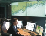
[[File:VTS-Hki-emasalo-ows.jpg|right|thumb|150px|Vessel traffic system]] | [[File:VTS-Hki-emasalo-ows.jpg|right|thumb|150px|Vessel traffic system]] | ||
The [[wikipedia:Automatic Identification System|Automatic Identification System (AIS)]] is perhaps the biggest technological advance in maritime navigation, since the introduction of radar. The service is a shipboard broadcast system that acts like a transponder, operating in the VHF maritime band and transmitting real time information of the vessel, in a similar manner as | The [[wikipedia:Automatic Identification System|Automatic Identification System (AIS)]] is perhaps the biggest technological advance in maritime navigation, since the introduction of radar. The service is a shipboard broadcast system that acts like a transponder, operating in the VHF maritime band and transmitting real time information of the vessel, in a similar manner as ADS-B <ref name="navcen" >[http://www.navcen.uscg.gov Navigation Center Portal], U.S. Coast Guard NAVCEN</ref> for aviation. | ||
In the same way as [[Air Traffic Control|ADS-B]], the AIS relies on GNSS as primary positioning source. | |||
The [[wikipedia:Vessel traffic service|Vessel Traffic Service (VTS)]] provides active monitoring and navigational advice for vessels in particularly confined and busy waterways.<ref name="navcen" /> Usually the VTS integrates in a command and control room, information from sources such as radar, AIS and closed circuit television sites. | The [[wikipedia:Vessel traffic service|Vessel Traffic Service (VTS)]] provides active monitoring and navigational advice for vessels in particularly confined and busy waterways.<ref name="navcen" /> Usually the VTS integrates in a command and control room, information from sources such as radar, AIS and closed circuit television sites. | ||
Latest revision as of 20:24, 9 September 2018
| Applications | |
|---|---|
| Title | Maritime Applications |
| Edited by | GMV |
| Level | Intermediate |
| Year of Publication | 2011 |
According with International Maritime Organization (IMO), Shipping is the most international of all the world's great industries. In fact a huge number of vessels moves around the world each day, making the efficiency, safety and optimization of marine transportation key issues.
GNSS technology will be fundamental for bringing innovation and progress in navigation and many other marine activities such as fishing, oceanography and oil and gas exploitation. Satellite navigation benefits all maritime applications, including leisure boats, commercial vessels, and unregulated and Safety of Life at Sea (SOLAS) regulated ships. Each application will take advantage of the new characteristics offered by GNSS augmentation: increased accuracy and integrity, certified services and high availability.[1]
GNSS will be used in every phase of marine navigation: ocean, coastal, port approach and port manoeuvres, under all weather conditions.[2]
Overview of Maritime Applications
GNSS is used mainly in maritime en route navigation and in support to the AIS and VTS systems which are maritime traffic collision and traffic control mechanisms. In maritime en route navigation there are two categories of applications, the chart plotters receivers and fish finder applications.
Besides the above mentioned applications, there are several other utilizations of GNSS in maritime applications, such as:[3]
- Observing the changes of sea level,
- Dredging operations,
- Wrecks location,
- Laying pipe lines,
- Search and Rescue of sinking vessels,
- Dynamic positioning,
- Positioning of oil rigs and
- Fixing of satellite sea launch platforms.
Nowadays, ship navigation casualties and incidents can result in serious loss of life and pollution of the marine environment as modern ship can carry over 5,000 people and over 500,000 tons of petroleum.[4] A wide variety of vessels moves around the world each day. The efficiency, safety and optimization of marine transportation are key issues.[1]
Due to the presented reasons, GNSS is being adopted as a marine navigation tool because it provides a reliable and short cost solution, allowing interoperability across navigational areas and with great impact in safety and commercial benefits, for all maritime purposes, including leisure boats, commercial vessels, unregulated and Safety of Life at Sea (SOLAS) regulated ships.[1]
Detailed information about En Route Navigation can be found here.
AIS/VTS
The Automatic Identification System (AIS) is perhaps the biggest technological advance in maritime navigation, since the introduction of radar. The service is a shipboard broadcast system that acts like a transponder, operating in the VHF maritime band and transmitting real time information of the vessel, in a similar manner as ADS-B [5] for aviation. In the same way as ADS-B, the AIS relies on GNSS as primary positioning source.
The Vessel Traffic Service (VTS) provides active monitoring and navigational advice for vessels in particularly confined and busy waterways.[5] Usually the VTS integrates in a command and control room, information from sources such as radar, AIS and closed circuit television sites.
Detailed information about AIS/VTS can be found here.
Notes
References
- ^ a b c ESA Portal, Maritime Navigation Applications
- ^ Galileo Application Sheet - Maritime Applications, ESA and European Commission, October 2002
- ^ GSA METIS, November 2007
- ^ New role of GNSS in the safety of maritime navigation, R. La Pira, Italian Naval Academy, La Revista 37, 2010, Instituto de Navegación de España


