If you wish to contribute or participate in the discussions about articles you are invited to contact the Editor
Autonomous Applications: Difference between revisions
Rui.Pereira (talk | contribs) mNo edit summary |
No edit summary |
||
| (7 intermediate revisions by 4 users not shown) | |||
| Line 1: | Line 1: | ||
{{Article Infobox2 | {{Article Infobox2 | ||
|Category=Applications | |Category=Applications | ||
| | |Editors=GMV | ||
|Level=Intermediate | |||
|Level= | |||
|YearOfPublication=2011 | |YearOfPublication=2011 | ||
|Logo=GMV | |Logo=GMV | ||
}} | }} | ||
Driverless cars are ubiquitous in imagined future scenarios. Autonomous vehicles technology is a multi-disciplinary technology where different engineering areas, such as Navigation, are required. GNSS systems where revolutionary in the area of Navigation by providing positioning and navigation capabilities to the autonomous vehicles. With precise positioning, GNSS can be used for lane or track determination (for road and rail vehicles) and attitude determination by using multiple antennas. | |||
Driverless cars are ubiquitous in imagined future scenarios. Autonomous vehicles technology is a multi-disciplinary technology where different engineering areas are required. | |||
Autonomous vehicle technology is still at its infancy but currently the first laboratory prototypes are being tested and demonstrated. GNSS has been one of the key drivers for the recent developments in this area. | Autonomous vehicle technology is still at its infancy but currently the first laboratory prototypes are being tested and demonstrated. GNSS has been one of the key drivers for the recent developments in this area. | ||
| Line 19: | Line 17: | ||
The main drivers for achieving autonomous driving is the reduction of traffic accidents by eliminating human error, increasing road capacity and traffic flow by reducing distance between cars and making use of traffic management information, relieving the car occupants from driving and navigation activities and allowing them to engage in other activities or rest<ref>[[Wikipedia:Driverless car|Driverless car on Wikipedia]]</ref>. | The main drivers for achieving autonomous driving is the reduction of traffic accidents by eliminating human error, increasing road capacity and traffic flow by reducing distance between cars and making use of traffic management information, relieving the car occupants from driving and navigation activities and allowing them to engage in other activities or rest<ref>[[Wikipedia:Driverless car|Driverless car on Wikipedia]]</ref>. | ||
A driverless car requires the combination of several techniques among which GNSS | A driverless car requires the combination of several techniques among which GNSS. These techniques will enable to guide autonomously a land vehicle from one point to another using public roads. In autonomous driving, GNSS can be used for navigation by determining the vehicle location and speed. With this information the vehicle route can be decided using digital maps. Lane and attitude determination could also benefit from GNSS if the accuracy is good enough. If the location information is shared among cars, GNSS could be a part of a short-range situation awareness system (awareness of other vehicles in the road and collision avoidance) although it is not expected that GNSS is the sole means of information for short-range situation awareness. | ||
Detailed information about Autonomous Driving can be found [[Autonomous Driving|here]]. | Detailed information about Autonomous Driving can be found [[Autonomous Driving|here]]. | ||
| Line 27: | Line 25: | ||
[[File:Pteryx UAV - wiki.jpg|right|thumb|150px|Autonomous Flying]] | [[File:Pteryx UAV - wiki.jpg|right|thumb|150px|Autonomous Flying]] | ||
Advanced UAVs (Unmanned Aerial Vehicles) are used or proposed in many missions covering security (including border patrol, anti-drug warfare, chemical, biological and radiological detection, maritime vessel identification and interdiction), surveillance of infrastructures (pipelines, power lines, railways, waterways, roads, airports), search and rescue, mapping, fisheries, agriculture, forestry, natural resource monitoring, fire fighting and emergency management, airborne communication collection and relay, weather data collection, environmental monitoring, pollution detection and other scientific research<ref> | Advanced UAVs (Unmanned Aerial Vehicles) are used or proposed in many missions covering security (including border patrol, anti-drug warfare, chemical, biological and radiological detection, maritime vessel identification and interdiction), surveillance of infrastructures (pipelines, power lines, railways, waterways, roads, airports), search and rescue, mapping, fisheries, agriculture, forestry, natural resource monitoring, fire fighting and emergency management, airborne communication collection and relay, weather data collection, environmental monitoring, pollution detection and other scientific research<ref> Feasibility Study for an Unmanned Aerial System Mission Supported by Integrated Space Systems, ESA Portal, July 2009</ref>. | ||
GNSS plays a very important role in UAVs. Either | GNSS plays a very important role in UAVs. Either when guided autonomously or guided by ground-based pilots, the determination of the location and speed of the UAV either for navigation or georeferencing the collected data is usually done by GNSS. If the vehicle is autonomous, GNSS can contribute actively to the control loop of the UAV by providing inputs to the control algorithm and by giving feedback to the control algorithm after an action is taken. | ||
Detailed information about Autonomous Flying can be found [[Autonomous Flying|here]]. | Detailed information about Autonomous Flying can be found [[Autonomous Flying|here]]. | ||
Latest revision as of 17:00, 9 September 2018
| Applications | |
|---|---|
| Title | Autonomous Applications |
| Edited by | GMV |
| Level | Intermediate |
| Year of Publication | 2011 |
Driverless cars are ubiquitous in imagined future scenarios. Autonomous vehicles technology is a multi-disciplinary technology where different engineering areas, such as Navigation, are required. GNSS systems where revolutionary in the area of Navigation by providing positioning and navigation capabilities to the autonomous vehicles. With precise positioning, GNSS can be used for lane or track determination (for road and rail vehicles) and attitude determination by using multiple antennas.
Autonomous vehicle technology is still at its infancy but currently the first laboratory prototypes are being tested and demonstrated. GNSS has been one of the key drivers for the recent developments in this area.
Autonomous Driving
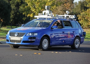
The main drivers for achieving autonomous driving is the reduction of traffic accidents by eliminating human error, increasing road capacity and traffic flow by reducing distance between cars and making use of traffic management information, relieving the car occupants from driving and navigation activities and allowing them to engage in other activities or rest[1].
A driverless car requires the combination of several techniques among which GNSS. These techniques will enable to guide autonomously a land vehicle from one point to another using public roads. In autonomous driving, GNSS can be used for navigation by determining the vehicle location and speed. With this information the vehicle route can be decided using digital maps. Lane and attitude determination could also benefit from GNSS if the accuracy is good enough. If the location information is shared among cars, GNSS could be a part of a short-range situation awareness system (awareness of other vehicles in the road and collision avoidance) although it is not expected that GNSS is the sole means of information for short-range situation awareness.
Detailed information about Autonomous Driving can be found here.
Autonomous Flying
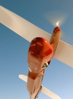
Advanced UAVs (Unmanned Aerial Vehicles) are used or proposed in many missions covering security (including border patrol, anti-drug warfare, chemical, biological and radiological detection, maritime vessel identification and interdiction), surveillance of infrastructures (pipelines, power lines, railways, waterways, roads, airports), search and rescue, mapping, fisheries, agriculture, forestry, natural resource monitoring, fire fighting and emergency management, airborne communication collection and relay, weather data collection, environmental monitoring, pollution detection and other scientific research[2].
GNSS plays a very important role in UAVs. Either when guided autonomously or guided by ground-based pilots, the determination of the location and speed of the UAV either for navigation or georeferencing the collected data is usually done by GNSS. If the vehicle is autonomous, GNSS can contribute actively to the control loop of the UAV by providing inputs to the control algorithm and by giving feedback to the control algorithm after an action is taken.
Detailed information about Autonomous Flying can be found here.
Notes
References
- ^ Driverless car on Wikipedia
- ^ Feasibility Study for an Unmanned Aerial System Mission Supported by Integrated Space Systems, ESA Portal, July 2009


